HIKE TO: San Jacinto Peak (2nd tallest peak in Southern California)
TRAIL: Marion Mountain Ridge Trail
MILES: 14.91 miles
TIME: 9 hrs 15 mins (plus another hr at the at peak)
DATE I WENT: 6/13/15
DIFFICULTY: strenuous
ELEVATION: 10,834 ft
ELEVATION GAIN: 4,364 ft
HIKE PERMIT: yes
PARKING PERMIT: no
LOCATION: San Jacinto Wilderness, Palm Springs
Last month, [6.13.15] two weeks after hiking the fourth peak of the SoCal Six Pack of Peaks, I reached my fifth summit – San Jacinto Peak. It was one of the most incredible summit views I’ve ever seen. I can’t decide which I liked more, San Jacinto Peak or Cucamonga Peak, but I think Mt. San Jacinto wins.
This was the first hike I’d done with my backpacking pack and I went into it mentally prepared this time. Although it was a long, exhausting day, I got through it all and enjoyed most of the hike until the end — coming down just never seemed to end.


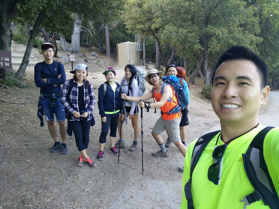
I went with my coworker, boss, and his friends. We met up at 5:30 am, trekked out to get breakfast, and pick up a day permit before starting the hike around 8:35 am. It was different hiking with a group, but of course, we eventually all split apart. We 3 stayed together since our packs were heavy and slowed us down, as opposed to everyone else without the pack that trekked along at a much faster pace. I think I estimated my bag to be roughly 15 lbs. My bag was practically the same size as mine, but it definitely felt more comfortable on my back than a regular daypack since the weight is distributed evenly along the back. The large backpack does take some getting used to though because it keeps your back up-right proper and I’m used to being able to hunch over and slouch when I’m tired… which I know is a bad habit.
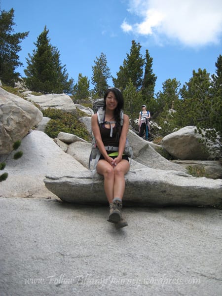
San Jacinto Mountain from Marion Mountain Ridge Trail
We hiked the Marion Mountain Ridge trail and I was warned that’s the hardest trail, primarily because it’s the shortest route up to the peak. It was definitely a challenge. We parked at the 2E14 sign and headed up the trail, but this wasn’t exactly the start of the trail. The actual trailhead for the Marion Mountain Trail started about 2 miles later.
During those first two miles, you come to a point where there’s a road and the trail splits in two directions. We were confused because no other bloggers wrote about this, but we kept left and it seemed to be the right choice. The trail starts with a steep ascent and keeps like this most of the way until you get to Little Round Valley Campground, where it is relatively flat for a while before the trail becomes a steep scramble up the last 0.3 miles. The trail is overall well-maintained. I don’t know if it’s the weather or the time we went, but it was mostly shady on the way up.


At the end of Little Round Valley Camp, we met these ladies that were very experienced hikers. They summitted Whitney almost every year so they were giving us tips which was really nice. I’ve noticed hikers are a lot friendlier than the average person: they are all about helping each other and the world seriously needs more good human beings like that.


The last stretch: When I said scrambling… I mean it. The beginning part of this last section was not too bad of an incline, although the trail got a little harder to follow at points, but then you literally scramble and climb on top of rocks and huge boulders to get to the peak. We stayed to the right side of the boulders but I heard both ways get you up there.



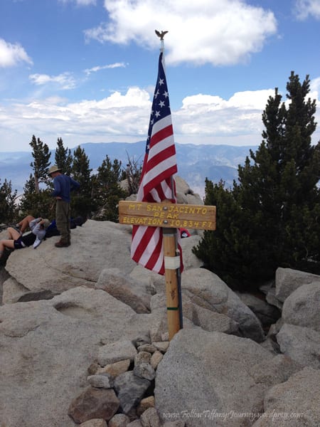
San Jacinto Peak
I still remember my first word when I got a glimpse of the peak’s view was WOW. I stood there in awe for like a second to take it all in before I was rushed from blocking traffic. It’s really like nothing I’ve ever seen in real life. You see pictures… but wow. No words can do this view justice. Well, maybe John Muir: the view from San Jacinto is the most sublime spectacle to be found anywhere on this earth. You can see Lake Perris from here and San Gorgonio I think (although I don’t know exactly which mountain top it was).


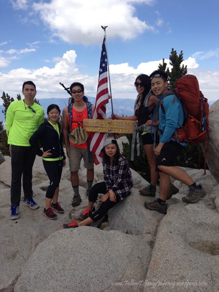


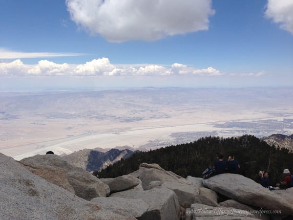
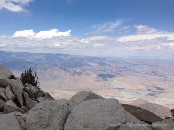


Timeline: We started hiking at 8:35 am, started the actual trail at 8:56 am, and arrived at the top at 1:48 pm. Headed down around 2:47 pm and got back to the parking lot at 6:50 pm. So roughly 5 hrs 15 mins to the top, and 4 hours down.


Tiff, the owner and author of Follow Tiff’s Journey, is a California/ Colorado-based adventurer and outdoor connoisseur who divides her heart between the Eastern Sierra Mountains and the Colorado Rocky Mountains. Despite her fear of heights, she’s become a seasoned mountaineer, ultralight hiking and backcountry camping enthusiast, expert road trip planner, and a fervent explorer of alpine lakes, natural hot springs, and sandstone canyons.
With 10 years of experience exploring the outdoors, her blog is your go-to source for all things wilderness, offering invaluable insights and pro tips, essential gear recommendations, and awe-inspiring stories from her adventures.
Join Tiff on her quest to share the wonders of nature and inspire others to follow their own path in the great outdoors.


How heavy was the backpack?
What backpack gear did you use?
I got the Osprey Aura AG 50 and it weighted roughly 15 lbs.