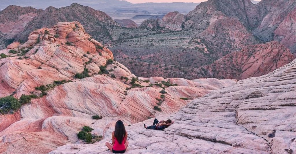


Compare Candy Cliffs, White Pocket, the Fire Wave, and Bentonite Hills by scenery, hiking effort, road access, and season so you can choose the right desert adventure.
Candy Cliffs near St. George, White Pocket in northern Arizona, the Fire Wave in Nevada’s Valley of Fire State Park, and Bentonite Hills near Hanksville, Utah are four beautiful alternatives to The Wave. None requires entering The Wave’s permit lottery, but getting to each one is a very different experience. Candy Cliffs is a good pick for a Southern Utah hiking trip, White Pocket takes more planning for the drive, and the Fire Wave works well for a shorter hike on a Las Vegas getaway. Bentonite Hills is the farther-away choice for a Hanksville or Capitol Reef trip.
I’ve explored all four, and they’re worth planning a trip around even if The Wave isn’t on your itinerary. I was lucky to see Candy Cliffs at sunset, visited White Pocket on a winter road trip, and have returned to Valley of Fire for more exploring. There’s a lot more to the Southwest than one famous sandstone formation.
If you didn’t get a Wave permit, you still have some pretty incredible options. Just choose one that actually fits where you’re staying, your vehicle, and how much time you have.
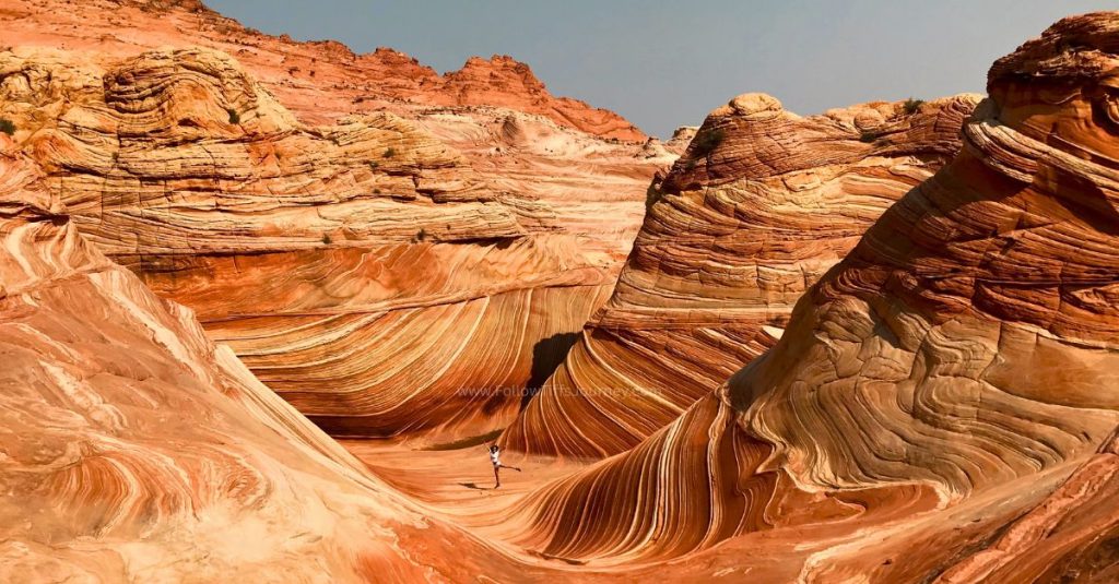
Which Wave alternative should you choose?
| Alternative | Why I’d choose it | Hiking distance | Getting there | Good base |
|---|---|---|---|---|
| Candy Cliffs / Yant Flat, Utah | Swirling sandstone and room to explore | About 3 miles round trip on my visit; more if you explore farther | Unpaved access road; check conditions after storms | St. George |
| White Pocket, Arizona | Unusual white-and-pink rock formations and a remote desert outing | Variable exploring; no developed trail network | High-clearance 4WD required; consider an authorized guide | Kanab or Page |
| Fire Wave, Nevada | A short hike to striped sandstone with more park sights nearby | My original visit was about 1.2 miles round trip; the park lists the combined Fire Wave/Seven Wonders route at 1.8 miles | Paved park roads, subject to entrance restrictions | Las Vegas or Overton |
| Bentonite Hills, Utah | Colorful clay hills and photography on a Hanksville/Capitol Reef trip | Variable exploring; not a fixed hiking trail | Choose the exact area first; unpaved roads and wet clay need careful planning | Hanksville or Capitol Reef region; farther northeast |
Distances depend on the route you follow and how much exploring you do. The Fire Wave is inside Valley of Fire State Park, so the Fire Wave and Valley of Fire count as one option. Bentonite Hills is the fourth destination on this list.
These also aren’t all next door to The Wave. White Pocket fits the Kanab/Page region, while Candy Cliffs and Valley of Fire make more sense as stops on a broader Southwest road trip. Bentonite Hills is much farther northeast, so I’d save it for a Hanksville/Capitol Reef trip or a longer Utah itinerary. If you’re coming from the west on a short trip, focus on the first three. If you’re already in Page and only have a few hours, see the New Wave option below.
1. Candy Cliffs at Yant Flat: swirling sandstone near St. George, Utah
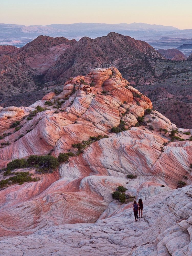
Candy Cliffs is one of my favorite hiking spots around St. George. You’ll also see it called Yant Flat, and the colorful swirls are the reason it belongs on this list.
The landscape opens into rounded sandstone with bands of orange, cream, and pink. You can spend time looking at the patterns up close or taking in the wider views. It’s a different formation than The Wave, but if colorful sandstone is what caught your attention in the first place, I’d put this one high on your list.
What is the hike like?
On my visit, the hike was about 1.5 miles one way. Your total distance will depend on where you turn around and how far you wander once you reach the rock formations.
The approach follows a sandy dirt trail before opening onto sandstone. Exploring the cliffs adds uneven ground and sloping rock, so I’d wear hiking shoes with good traction and stay within terrain you’re comfortable coming back down. A short hike doesn’t mean every slope is easy to walk on.
I saw Candy Cliffs at sunset, and the evening light added even more color to the rocks. If you go later in the day, leave enough time for the return hike and bring a headlamp.
What to know before you go
There’s no hiking permit or entrance fee currently listed for Yant Flat, but the dirt-road access is worth checking before you commit. Rain and snow can change the drive, and a dry-weather trip report won’t tell you what the road looks like after a storm. The time of day makes a big difference for photo ops. I’ve been in the morning and sunset and it looks like two completely different places without the soft sunlight.
👉 I’d choose Candy Cliffs if you’re staying in St. George or already traveling through Southern Utah. You can build more time around the area with my St. George guide, which includes Snow Canyon and other nearby adventures.
👉 Want to go with a guide? Check availability for this Candy Cliffs guided hike on Viator.
2. White Pocket: a remote Wave alternative in Arizona

White Pocket looks like another planet. The white-and-pink striations, rounded rock, and unusual textures make it a completely different experience from following a trail to one viewpoint.
I visited on a winter road trip from Kanab, and this is a place I’d leave plenty of time to explore. You don’t have to rush straight to a particular photo spot and leave—there’s a lot to look at once you’re there.
The drive is the biggest planning consideration
White Pocket requires a high-clearance 4WD vehicle. The access roads include deep sand and rocky sections, and BLM warns that visitors get stranded after attempting the drive in unsuitable vehicles or without enough experience. If you’re uncertain about the drive, BLM recommends using an authorized guide. Read the current White Pocket access guidance before choosing a vehicle or tour.
On our trip, coming in from the south took about two hours from Kanab. That’s my trip timing, not a guaranteed drive time. Road conditions, your route, and your driving experience can change it considerably.
I wouldn’t squeeze White Pocket into a spare hour between other stops. Give it a dedicated day, especially in winter when daylight is shorter.
What is the White Pocket hike like?
There isn’t a developed hiking trail network once you reach the formations, so mileage depends on how much exploring you do. Expect uneven sandstone, slopes, and some route-finding rather than a consistently marked path.
White Pocket does not currently require The Wave’s lottery permit. It’s a separate destination, and access to White Pocket does not allow you into the nearby Coyote Buttes permit areas.
Stay on durable surfaces, avoid fragile edges and soil crusts, and leave the rock pools undisturbed. Bring your own water, food, and offline navigation.
👉 For more stops to build around this day, read my Kanab adventure guide.
👉 Rather leave the drive to someone else? Check out this White Pocket guided day tour from Kanab on Viator.
3. The Fire Wave in Valley of Fire State Park, Nevada

The Fire Wave is a good option if you want a shorter hike to colorful striped sandstone without planning a remote 4WD outing. It’s located inside Valley of Fire State Park, which also gives you plenty of other places to explore in the same day.
I used to pass Valley of Fire on my Southwest road trips from Southern California and tell myself I’d stop on the way home if I wasn’t tired. Eventually, I put it at the beginning of the trip instead—and I’m glad I did.
What is the Fire Wave hike like?
My original hike to the Fire Wave was about 0.6 miles each way. The park’s brochure lists the combined Fire Wave/Seven Wonders route at 1.8 miles, so check which route you’re following when comparing distances.
It’s a short hike, but it’s exposed. On a late-spring visit, temperatures were already in the 80s and 90s. My return visit in late February was much more comfortable, and we hiked near sunset to end the day. We did have to hurry out before the park closed, so learn from that and give yourself more time.
Seasonal closures and park fees
The Fire Wave and several connected trails close annually from May 15 through September 30. An early start doesn’t make a closed trail available.
Valley of Fire also currently lists an annual full park closure from December 1–14, including access on foot. Outside closures, day-use hours are sunrise to sunset. Vehicle entry currently costs $10 for Nevada vehicles or $15 for out-of-state vehicles. Check Nevada State Parks’ current information before your trip.
For travel through the end of 2026, also check the west entrance construction alert. Weekday restrictions can change which entrance you need to use.
Make time for more of Valley of Fire
I’d plan more than just the Fire Wave. White Domes surprised me on my second visit, and the park’s other trails give you different views of the sandstone. Choose additional stops based on what’s open and how much daylight you have.
👉My Valley of Fire guide covers the places I explored across two visits, including White Domes, Mouse’s Tank, and Pink Canyon.
👉 Want a guided day in the park? Check out this Valley of Fire hiking tour from Las Vegas. Confirm whether the route includes the Fire Wave on your travel date, since routes and closures can vary.
4. Bentonite Hills near Hanksville, Utah: a farther-away, remote alternative
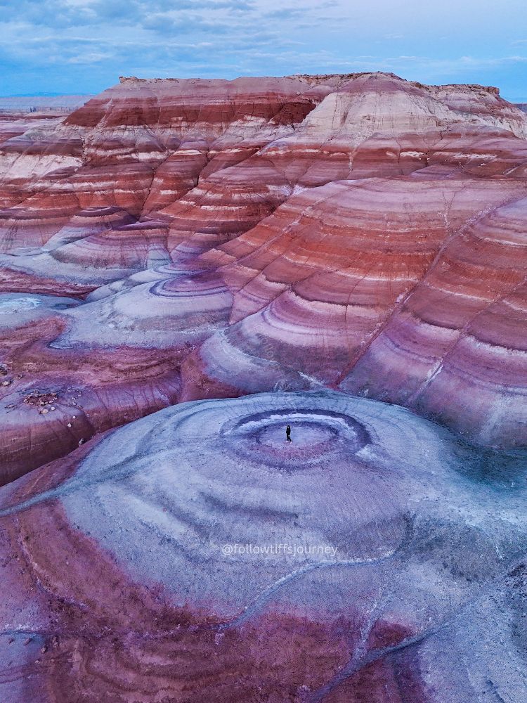
Bentonite Hills belongs on this list if colorful, otherworldly desert scenery is what drew you to The Wave. Think softly rounded hills with bands of purple, gray, red, and green instead of a sandstone corridor. It’s a different landscape, and more of an exploring and photography outing than a hike to one specific formation.
This is the option I’d plan as a separate region. Hanksville is much farther northeast than the first three destinations. If you’re coming from California or Las Vegas for a short getaway, I wouldn’t add it just to check off another Wave alternative. It makes more sense when you’re already exploring Hanksville and Capitol Reef, or have extra days for a longer Utah road trip.
What to expect at Bentonite Hills
My honest take: the colors don’t look as vivid to the naked eye as many edited photos online. Light makes a big difference. I’d go for the unusual patterns and landscape, without expecting every view to match a saturated aerial photo. There isn’t a fixed mileage goal here; how long you stay depends on your chosen area and how much time you spend taking photos.
Choose the right access route before you go
More than one area is called Bentonite Hills. BLM’s Hanksville driving guide describes the colorful hills along Cow Dung Road near the Mars Desert Research Station. The station isn’t open for public visits; use the designated viewing area. The NPS Bentonite Hills page describes the separate Hartnet Road/Cathedral Valley area, where high clearance is required. Don’t assume a map pin or tour visits the same location as a photo you saved.
Check the exact route and current conditions before driving. Clay roads can become impassable after rain or snow, and wet ground can be difficult to walk on too. Stay on designated roads and firm, previously disturbed ground; don’t climb fragile hillsides just to recreate a photo.
👉 My Bentonite Hills guide shares more of my experience. For another outing in the region, see my Moonscape Overlook guide, checking its access separately.
👉 Prefer a guided outing? Check this Bentonite Hills and Cathedral Valley tour on Viator. Confirm the meeting point and which Bentonite Hills area it visits before booking; this is a Capitol Reef-region tour, rather than a promise to visit every Hanksville photo location.
Need a quick alternative near Page? Consider the New Wave
If you’re already in Page and want a shorter local outing, the New Wave is another option to research. Page’s tourism office describes it as an easy sandstone loop near the Wahweap South Entrance, without The Wave’s lottery requirement. It looks to have a similar formation to the swirls of the wave but without all the colors.
I’m including this as a researched option rather than a firsthand trip report. It may fit your day better than driving to St. George or Nevada after an unsuccessful lottery entry. Check Page’s hiking information for details.
When should you plan a desert hiking trip?
Fall, winter, and spring are the seasons I’d look at first for these adventures. I love exploring the Southwest when the temperatures cool down, but winter desert trips still need a weather plan.
White Pocket, Candy Cliffs, and Bentonite Hills can have snow, ice, or difficult road conditions. Valley of Fire has its own closure calendar. Choosing a month is only the first step; the forecast and actual access conditions decide what makes sense that day.
For a cold-weather trip, I’d:
- Choose the main adventure first. Decide whether you want a shorter park hike, a sandstone exploring day, or a remote 4WD outing.
- Stay in the region that fits it. St. George for Candy Cliffs, Kanab or Page for White Pocket, Las Vegas or Overton for Valley of Fire, and Hanksville or the Capitol Reef region for Bentonite Hills.
- Keep a flexible day. A storm can change a dirt-road plan, even if the following afternoon looks sunny.
- Plan around daylight. Leave time to hike out, drive back, and follow park closing hours.
You can connect these places on a longer trip, but I wouldn’t try to check off all four on a quick weekend. Pick a region and enjoy it.
What to pack for these desert adventures
Even for a short hike, I’d bring:
- Hiking shoes with good grip on sand and sandstone
- Water for the full outing, plus extra in the vehicle
- Snacks or lunch, depending on the day
- Sun protection—cool air doesn’t mean you won’t get sun
- Warm layers, a windproof shell, and gloves for cold mornings
- Offline maps and a charged phone with backup power
- A headlamp, basic first aid supplies, and a plan shared with someone at home
For White Pocket, your preparation also needs to cover the remote drive. Hiking gear won’t solve an unsuitable vehicle or a road that’s impassable after weather.
Booking travel soon?
Please consider using my affiliate links below. It costs nothing additional for you but helps me maintain the ever-increasing costs of running a travel blog:
General travel through Tripadvisor here.
Book your flights here.
Book your accommodations here on Expedia, Booking.com, Hotels.com, and VRBO.
Book your car rentals here.
Book your tours here.
Book your travel insurance here.
Shop my favorite gear here.
Want help planning your Southwest desert trip?
Choosing the hike is the fun part. Figuring out which town to stay in, what your vehicle can reach, and how much you can realistically fit into a winter day takes a little more work.
I’ve spent 10+ years road-tripping through Utah, Arizona, and Nevada, and I offer custom travel planning to help you turn those saved places into a trip that fits your interests and hiking experience.
Whether you want a weekend around St. George or a longer Southwest adventure, I can help with a personalized itinerary, trail choices, and seasonal planning. I create your plan and advise on permits; you make your own bookings and permit applications.

FAQs: alternatives to The Wave
Can you hike The Wave without a permit?
No. You need a permit to enter Coyote Buttes North, where The Wave is located. Visiting an alternative does not grant access to that area. My Wave hiking and permit guide covers planning for the original hike, and BLM maintains the official permit information.
Is the Fire Wave the same as The Wave in Arizona?
No. The Fire Wave is inside Valley of Fire State Park in Nevada. The Wave is in Coyote Buttes North in Arizona. They have separate access rules, and you don’t need to win The Wave lottery to hike the Fire Wave.
Which alternative works best without a 4WD vehicle?
Of these four, I’d look at the Fire Wave first because it’s reached by paved park roads. Check park and entrance closures before going. White Pocket requires high-clearance 4WD access; an authorized guided trip is an option if you don’t have the vehicle or driving experience.
Is winter a good time to visit these Wave alternatives?
It can be, and I’ve enjoyed winter visits in the Southwest. Expect cold temperatures, shorter days, and possible snow or ice. Check dirt-road conditions for White Pocket, Candy Cliffs, and Bentonite Hills, and plan around Valley of Fire’s December closure.
Which place should I visit if I didn’t win The Wave lottery?
If you’re staying around Kanab or Page, look at White Pocket with suitable transportation, or research the New Wave for a shorter outing near Page. If you’re still planning your route, Candy Cliffs and the Fire Wave are worth building into a Southern Utah or Nevada trip.
Which would you choose: Candy Cliffs, White Pocket, the Fire Wave, or Bentonite Hills? Let me know in the comments—and if you’re still hoping to hike the original Wave, keep a few other adventures on your list too.


Tiff, the owner and author of Follow Tiff’s Journey, is a California/ Colorado-based adventurer and outdoor connoisseur who divides her heart between the Eastern Sierra Mountains and the Colorado Rocky Mountains. Despite her fear of heights, she’s become a seasoned mountaineer, ultralight hiking and backcountry camping enthusiast, expert road trip planner, and a fervent explorer of alpine lakes, natural hot springs, and sandstone canyons.
With 10 years of experience exploring the outdoors, her blog is your go-to source for all things wilderness, offering invaluable insights and pro tips, essential gear recommendations, and awe-inspiring stories from her adventures.
Join Tiff on her quest to share the wonders of nature and inspire others to follow their own path in the great outdoors.