HIKE TO: Big Basin Redwoods, Waddell Beach, Santa Cruz
TRAIL: Skyline to the Sea Trail
MILES: 32.1 mi
TIME: 3 days/ 2 nights
DATE I WENT: 10/31/18 - 11/2/18
DIFFICULTY: easy
ELEVATION: 3074 ft (at Castle Rock State Park trailhead)
HIKE PERMIT: yes
LOCATION: 2 California State Parks = Castle Rock State Park & Big Basin Redwoods State Park (Santa Cruz Mountains)

*update 2023: The Skyline to the Sea Trail is now partially reopened from Gazos Creek Road to North Escape Road)
If you’re looking for a popular backpacking trail in the Bay Area, the Skyline to the Sea Trail in Santa Cruz is it. You get to hike through TWO of California’s State Parks: Castle Rock State Park and Big Basin Redwoods State Park. This is a great backpacking option for the Fall and by the coastal breeze.

PERMITS:
You do not need a permit to hike the Skyline to the Sea Trail, but you do need a reservation for the backcountry trail camps which you can learn more about here. I hear this trail is very popular so you need to reserve it months in advance, but we went during a heatwave at the end of Oct 2018 and called one day ahead for permits on a weekday and didn’t see anyone until we arrived at Big Basin.
PLANNING the route/ parking:
There are two trailhead options for this hike: Saratoga Gap route which follows the actual Skyline to the Sea Trail, and the Castle Rock route which starts at the main Castle Rock entrance and is labeled the scenic route. Both end at Waddell Beach in Santa Cruz. Both trails are a one-way thru-hike so you’ll have to arrange a ride at the end. You can park your car at the Castle Rock trailhead but not the Saratoga Gap Trailhead which are three miles apart on the road, but the Castle Rock route adds two additional easy miles and is the route we took that I’ll be detailing in this trip report.
Arranging a ride: There are no public transportations in the area. I used my Garmin Mini InReach on the trail (any satellite phone will do) to let a friend know what time I’ll be exiting on the day of to get picked up, but there’s weak cell service at Waddell Beach also if you want to chance it.
Last thing to consider – direction of hiking: I’d strongly recommend starting at either trailhead on the east end and ending at the west on the beach. The views are better, you get a shower the second night, and the trail will be mostly downhill, making it an easy and enjoyable hike. Even though it’s called Skyline to the Sea… literally from the top of the mountain to the bottom ocean… I have heard some people hike this backward.
Day 1: Castle Rock Parking Lot/ Trailhead to Waterman Gap Trail Camp 9 miles

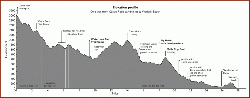
The Castle Rock route actually starts on the Saratoga Gap Trail (not to be confused with the Saratoga Gap route that starts on the Skyline to the Sea Trail), connects to the Travertine Springs Trail, and finally the Skyline to the Sea Trail where we camped the first night at Waterman Gap Trail Camp.
There is poison oak throughout the trail so be aware of that – even if the leaves are dry, you can still get infected from getting poked with the stems which happened to my partner. The trail the first day is mostly shaded and downhill. You start in the forest, quickly get some views of the wilderness as the trail opens up along the side of the mountain, then you end up back in the wilderness for the rest of the trail. It’s mostly downhill and there is one super short section that is along the cliff and has cables to hold onto, but nothing too daunting.


Castle Rock Trail Camp is the first campsite, only 2.3 miles from the trailhead, but not the one we planned to camp at. Here you will find some signs that may just confuse you (as it did with me and I took the wrong trail for a short while…) – stay on the Saratoga Gap Trail to Waterman Gap Trail Camp (6.7 mi) via Travertine Springs Trail. The water source here was shut off due to an issue with their water tanks so you’ll have to carry enough water to get to Waterman Gap Trail Camp. About half an hour from this point as you continue on, be sure to look out for the Travertine Springs Trail sign that heads down on your left because we were enjoying the fallen fall leaves too much and walked right passed it…

From the Saratoga Gap/ Travertine Springs Trail, you’ll connect to the Beekhuis Road hiking up 0.4 miles before connecting you to the Skyline to the Sea Trail. Once you reach this trail junction, you’re about an hour away from camp.


About 3:30 hr and 9 miles later, we made it to our home for the night, Waterman Gap Trail Camp. There are bear lockers at each of the 6 campsites, potable water, and a restroom as well. We had the entire campground to ourselves on Halloween night and saw the most incredible colorful sunset.
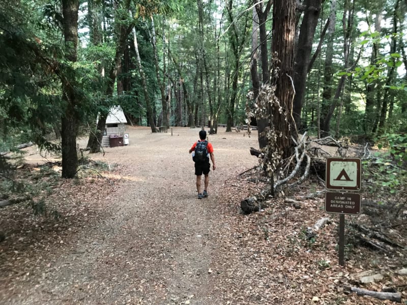


Day 2: Waterman Gap Trail Camp in Castle Rock State Park to Jay Camp in Big Basin Redwoods State Park 9.8 miles

Big Basin Headquarters is 9.5 miles from Waterman Gap so we got an early start at 7:40 am. Right away, you’ll have to cross the hwy road to stay on the trail. The trail is mostly covered in the trees, a few ups and downs but no drastic elevation gain and you’ll find yourself in Big Basin Redwoods State Park in no time, walking among the giant redwood trees.
We arrived at the Big Basin Headquarters early in the day at 12:30 pm and there was some cell signal or wifi at the nature museum so we rested there before heading to Jay Trail Camp. This is also a good place to touch base with your pick up ride if needed. It’s also the first time we saw people on the trail. The visitor center hours change in the Fall which I believe starts on Nov 1 (the day I arrived) so they happened to be closed. But check the hours ahead of time if you’re interested in getting some fresh food/ snacks/ cold beverages.
Jay Trail Camp is only 0.3 miles away from the museum and has 8 sites, potable water, a bear box and a restroom with HOT showers! The showers are coin-operated so bring quarters! If I recall correctly, it’s 25 cents per 2 minutes.


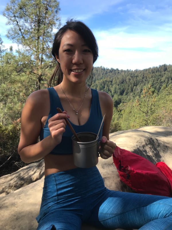

With the entire afternoon and evening free, we explored Big Basin State Park since it was my first time here. We saw the amphitheater and walked the most popular nature trail in the park: Redwood Loop trail (only 0.6 miles) which shows you the tallest tree in the park, the Mother of the Forest. It’s close to the headquarters and our camp.


Day 3: Jay Camp in Big Basin Redwoods State Park to Waddell Beach in Santa Cruz 13.3 miles
The next morning, our last day, we were off to another early start at 7:55 am. Head 0.3 miles back to the headquarters to continue on the Skyline to the Sea Trail. It is 12.5 miles to Rancho Del Oso Ranger Station/ end of Skyline to the Sea trail/ parking lot, another 0.4 miles to the actual end of this trail, and after crossing the street to Waddell Beach, you’re at a 13.3 mile day.
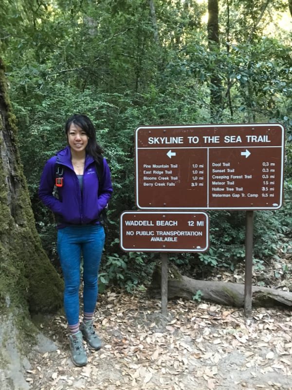
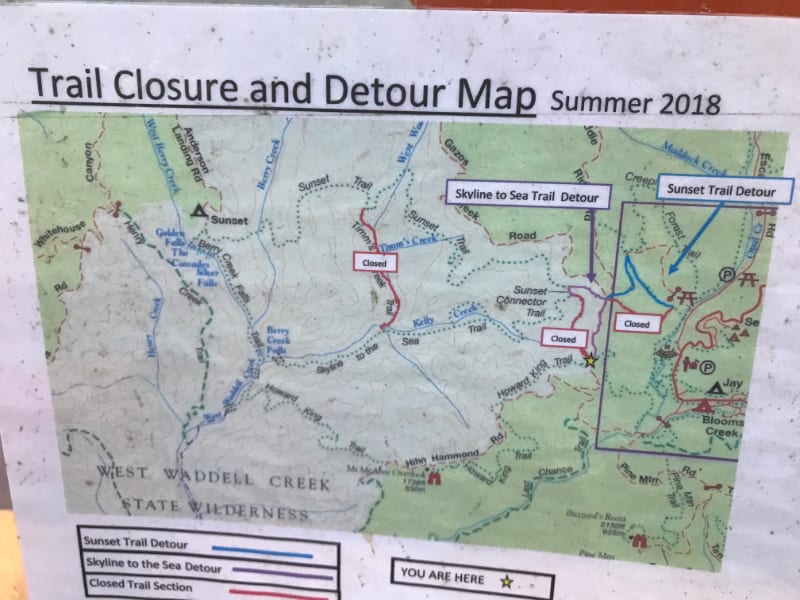


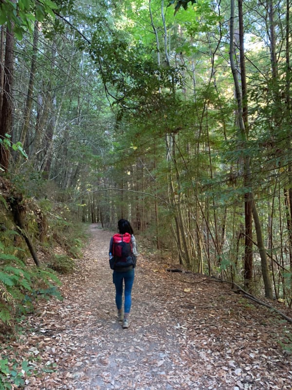


There was a detour in place because of trail closure in Summer 2018 so we went on a significant, but short, incline up/down Sunset Trail. Berry Creek Falls is also along this trail but you can only catch a glimpse of it from the trail and will need to take a short detour to get up close to it.


Gear I Used On This Trip
- Backpack: KS50
- Tent: Big Agnes Fly Creek
- Sleeping bag: Feathered Friends Murre EX 0°F
- Sleeping pad: Thermarest NeoAir XTherm Max
- Synthetic Jacket: Arc’teryx Atom LT
- Water filter: 1 Liter BeFree by Katadyn (2 oz)
- Headlamp: Nitecore NU25
- Satellite GPS: Garmin Mini InReach
- Map: https://www.parks.ca.gov/pages/538/files/CastleRockCGmap.pdf
Booking travel soon?
Please consider using my affiliate links below. It costs nothing additional for you but helps me maintain the ever-increasing costs of running a travel blog:
General travel through Tripadvisor here.
Book your flights here.
Book your accommodations here on Expedia, Booking.com, Hotels.com, and VRBO.
Book your car rentals here.
Book your tours here.
Book your travel insurance here.
Tiff, the owner and author of Follow Tiff’s Journey, is a California/ Colorado-based adventurer and outdoor connoisseur who divides her heart between the Eastern Sierra Mountains and the Colorado Rocky Mountains. Despite her fear of heights, she’s become a seasoned mountaineer, ultralight hiking and backcountry camping enthusiast, expert road trip planner, and a fervent explorer of alpine lakes, natural hot springs, and sandstone canyons.
With 10 years of experience exploring the outdoors, her blog is your go-to source for all things wilderness, offering invaluable insights and pro tips, essential gear recommendations, and awe-inspiring stories from her adventures.
Join Tiff on her quest to share the wonders of nature and inspire others to follow their own path in the great outdoors.

You post the best stuff. Thanks for all the new ideas and tips. Never stop exploring and blogging. 😛.
Thank you, James! Happy adventuring 🙂
Pingback: How to Plan An Epic Backpacking Trip | Follow Tiff's Journey