

TRIP DATES: November 13-15, 2020
LOCATION: San Bernardino Mountains, CA (Crestline/ Lake Arrowhead)
CAMP: Thousand Pines via
HIKES: Deep Creek Hot Spring, Heart Rock, & Pinnacles
National Take a Hike Day: Best Hikes Near Lake Arrowhead
There are 60k+ trails in the National Trail System and with the convenience of a cabin near Lake Arrowhead this past weekend, I got to explore 3 of the trails in San Bernardino National Forest within 24 hours!
I’ve been stuck in a rut lately. Maybe it’s the shorter days with daylight savings, maybe it’s the recent cold weather, or maybe my body has just gotten used to being at home since the mountains have been closed for most of Fall due to wildfires. Whatever the reason, I was eager to get back out and a quick little cabin getaway was just what I needed to reboot my mind and body.
Camping near Lake Arrowhead
You can easily book a campsite through – they’re the largest online marketplace for family campgrounds, cabins, glamping sites, and RV resorts with 500+ campgrounds (=100,000 campsites) in 49 states and even some in Canada! There’s also a “hiking” filter to help you search camp options that are near hiking trails. Although I do spend most of my nights outdoors in a tent in the summer, cabins and day hikes are my preference for the cold season.
I reserved the Oakwood Cabin at Thousand Pines Campground in Crestline, CA this past weekend because there were several trails in that area that I have wanted to explore for years but never wanted to make the effort during peak hiking season. Once the weather cools down though, it’s hard to want to drive out there for just a short day hike with made a cabin rental the perfect solution.
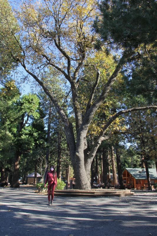
Thousand Pines Campground in Crestline is right by Lake Gregory, just 8 miles from Lake Arrowhead, and a 1.5-hr drive from LA/OC which makes it a great local weekend getaway. It was the cutest camp area in the middle of the forest surrounded by lush trees, fresh snow, cabins/yurts that were well-spaced out so each family has privacy, activities onsite such as archery and rock climbing, and the friendliest staff!
I loved that we could go for a sunset hike and come back in the dark to a warm cabin, a hot meal, a shower, and a bed.


Hiking Trails Near Crestline/ Lake Arrowhead
Each of the hiking trails was different and unique – one was a dry canyon to hot springs and a creek, one was a forested trail in the lush mountains ending at a small waterfall with a unique rock formation, and one was all desert/ boulders that resembled Joshua Tree/ Alabama Hills.
We arrived at our campground at 2 pm and were in a rush to make it out on a hike before we lost the daylight. After unloading our stuff in our cabin and driving out 30 mins, we arrived at our trailhead for the hot springs at 3 pm on Friday the 13th.
Crowds: We didn’t see anyone else on the hot springs trail and very few people on the pinnacles trail. My guess is because the days are shorter and it’s too cold to do sunset hikes – once the sun disappears, temps drop significantly. The heart rock trail was our only broad daylight hike and since it’s an easy one, there were a good amount of people on the trail but we were usually alone.
Deep Creek Hot Springs Hike
HIKE TO: Deep Creek Hot Springs
TRAIL: Bradford Ridge
MILES: 5.09 miles (out & back)
TIME: 2:40 hrs (1:14 hr down / 1:26 hr up)
DATE I WENT: 11/13/20
DIFFICULTY: moderate-strenuous
ELEVATION: 3513 ft
ELEVATION GAIN/ LOSS: 856 ft
LOCATION: San Bernardino National Forest
How to Get to Deep Creek Hot Springs
This is a hot spring I’ve been wanting to hike to for years but avoided due to crowds on the weekend and stories of car break-ins. There are 3-4 hiking trails that lead to Deep Creek Hot Springs and I opted for the more strenuous route because I like a good workout (hiking can burn 400-550 calories per hour) plus it was closest to access from Lake Arrowhead.
The Deep Creek Hot Springs trailhead we took begins at the Bradford Ridge Path on the east side of hwy 173. There is a small turnout for parking along the road with enough space for maybe 2-4 cars on each side.
Note: PLEASE don’t forget to practice Leave No Trace: Pack out what you pack in. Leave it better than you found it.
Bradford Ridge Trail to Deep Creek Hot Springs
The Bradford Ridge Trail is steep and in all of my research prep, every blog warned about the steep section and it honestly freaked me out. I’m glad I didn’t let that stop me from going though because although it was definitely steep (the max grade is 55% and the steepest section drops 581 ft in 0.5 mi), the trail conditions were not as bad as I expected – in fact, it wasn’t bad at all if you’re an avid hiker.
When we arrived at Deep Creek Hot Springs, there was a pleasant surprise of Fall colors in the canyon still and since there are many hot springs pools, we had a couple of them all to ourselves. There are camping options on the beaches along Deep Creek which would be a cool experience for a separate trip. There are at least 7 hot springs here, each with varying temperatures, and a cold, wide creek to plunge in but the creek can flow strong depending on the time of year so be mindful of that. We didn’t explore every pool but we did find a couple of amazing ones and watched the sunset and the stars come out before hiking back in pitch-black darkness.
I actually forgot my headlamp (I knew exactly where it was back in the cabin *facepalm*) and had to use my cell phone flashlight on the hike out but since it was a crescent moon, there was little light out which made star gazing incredible but the darkness was discomforting.
At one point, I heard a loud thump on the ground and knew there was a large animal nearby which freaked me out more so I started singing loudly and tried to distract myself. A little bit later, I heard other animal noises in the distance which resembled the sound of one creature getting attacked by another – maybe I’m building it up in my head but needless to say, I was freaked out the entire way back especially since I’m scared of the dark too. It’s been a while since I’ve hiked at night so my imagination gets the better of me… but it was 100% worth it.


Heart Rock Trail at Camp Seely
HIKE TO: Heart Rock
TRAIL: Heart Rock Trail (aka Seely/ Seeley Creek Trail)
MILES: 1.84 miles (out & back)
TIME: 2:40 hrs
DATE I WENT: 11/13/20
DIFFICULTY: easy
ELEVATION: 4147 ft
ELEVATION GAIN/ LOSS: 258 ft total from trailhead to end (gross 521 ft)
LOCATION: San Bernardino National Forest
Heart Rock Trail is a very popular hike in Lake Arrowhead because of the short distance, the flat trail, and the unique destination. The short and easy trail has been on my bucket list for years but because it’s so short and a bit further from the city, I never wanted to drive out just for this.
This little gem was only 10 mins away from our campground in Lake Arrowhead. The trail is straightforward, but we were distracted in conversation on the forest road and missed the turnoff to enter the actual trail 0.19 mi in from the parking lot outside Camp Seeley. Luckily, there was a connecting trail 0.37 mi in, and the Heart Rock Trail is only 0.9 mi one-way total. It starts at Camp Seely and hikes above along Seeley Creek the entire time. When you get to the end, there’s an overlook of heart rock which sits above a waterfall or you can climb down to it.
Climbing down into the hole was more challenging than I expected since the granite rock is very slippery. If you climb into the hole from above (which we saw a couple do when we first arrived – see photo below), the granite is very slick and a little steep so be prepared to drop into the hole.
If you climb into the hole from the left side (which I did), well it’s still a slippery struggle. I have long legs and had to hug the wall, crawl over and straddle it before dropping in just a few inches.
Climbing out was a different story since there are no hand-holds on the inside to grip onto if you miss a step sliding out. Luckily there’s a small ledge on the outside of the hole to assist you but please be cautious as it is all very slippery! I was terrified of slipping off and almost made my partner come give me a hand, but if you can control your weight distribution and grip the wall with your thighs, you’ll just inch your way down.


The Pinnacles of Lake Arrowhead
HIKE TO: The Pinnacles of Lake Arrowhead
TRAIL: Pinnacles Trail
MILES: 3.88 miles (out & back)
TIME: 2:40 hrs
DATE I WENT: 11/13/20
DIFFICULTY: moderate
ELEVATION: 5730 ft
ELEVATION GAIN/ LOSS: 976 ft
LOCATION: San Bernardino National Forest
I had no idea Lake Arrowhead had terrain like this – I actually discovered the Pinnacles in my research for nearby hiking trails.
The Pinnacles Trail resembles Joshua Tree and Alabama Hills a lot with the boulder terrain. The official Pinnacles Trail actually starts by the Arrowhead Fish & Gane Conservation Club but there is a trail from the official Pinnacles Trail Parking lot (there’s a sign and Google Maps goes directly there) that connects you to the Pinnacles Trail in 0.29 miles.
Once you’re on the Pinnacles Trail, you’ll vaguely follow a dry wash with the trail on your right side. The first half of the trail has a gradual incline and the entire trail is fully exposed.
At about 1 mile in, the fun part starts – the trail climbs 678 ft in 0.84 miles. The second half of the trail climbs up a lot of boulders and the cairns help mark the trail. There’s a worn-trail for the most part, but it takes a little bit of route-finding so if you’re planning to hike down in the dark as we did, it’s helpful to track your hike up so you have a route to follow coming down.
When you reach the top of the pinnacles area, the easiest way to get to the top is to crawl through the small triangular hole (when you see two small spaces, it’s the hole on the left; we went right which took a bit longer to go around and up).
The 360 degrees sunset view from up here is stunning with sights of Silverwood Lake, Mt. Baldy, Twin Peaks, and some other ones I can’t name. Once the sun went down though, it got cold fast.


Bonus Trail: Walk Around Lake Arrowhead
On Sunday morning after checking out, we headed over to Lake Arrowhead for my first time. It was hard to find public access to the lake but we ended up on the South Shore Trail for a walk along the lake near the village.


If you’re looking for a quick little getaway from LA, I’d recommend getting a cabin near Lake Arrowhead and exploring this area! It’s just 1.5 hr outside of LA and feels like a completely different world, especially with the snow!
The Wrap-Up: Things to do in Lake Arrowhead
Lake Arrowhead has many easy and family-friendly hiking trails. Hike to Deep Creek Hot Springs and enjoy a warm soak, hike to a unique heart-shaped rock, or go for a sunset hike and experience the pinnacles of Lake Arrowhead for some desert vibes in the mountains.
Booking travel soon?
Please consider using my affiliate links below. It costs nothing additional for you but helps me maintain the ever-increasing costs of running a travel blog:
General travel through Tripadvisor here.
Book your flights here.
Book your accommodations here on Expedia, Booking.com, Hotels.com, and VRBO.
Book your car rentals here.
Book your tours here.
Book your travel insurance here.
Shop my favorite gear here.
Thanks for reading!
I’d love to hear your thoughts – please let me know any questions, comments or suggestions in the comment section below and don’t forget to practice Leave No Trace 🙂
Tiff, the owner and author of Follow Tiff’s Journey, is a California/ Colorado-based adventurer and outdoor connoisseur who divides her heart between the Eastern Sierra Mountains and the Colorado Rocky Mountains. Despite her fear of heights, she’s become a seasoned mountaineer, ultralight hiking and backcountry camping enthusiast, expert road trip planner, and a fervent explorer of alpine lakes, natural hot springs, and sandstone canyons.
With 10 years of experience exploring the outdoors, her blog is your go-to source for all things wilderness, offering invaluable insights and pro tips, essential gear recommendations, and awe-inspiring stories from her adventures.
Join Tiff on her quest to share the wonders of nature and inspire others to follow their own path in the great outdoors.
Hi Tiff,
I LOVE your posts and blogging. I grew up in SoCal, but have lived in WA State for my entire adult life. This brings back fond memories of Lake Arrowhead, Big Bear, Mt. Baden Powell, etc. I’m traveling the entire Western USA in a Sprinter van, and plan on visiting my old stomping grounds soon… to log many miles hiking and punch an abundance of fun tickets.
Thank you for your inspiration!
Hi Wendell,
Thank you so much for the kind words 🙂 The vanlife lifestyle sounds fun – hope you’re having a great time exploring! There are so many incredible places along the Western US to see/hike, especially in the Southwest this time of year. We’re lucky to have mountains like San Bernardino and Angeles National Forest so close to LA.
Great blog
Thank you, Harv!
I just enjoyed the fact that one can go out and enjoy the same hike using your information. Don’t change a thing, everything you post is really good! Have a great Thanksgiving Day with your family. Be Safe!
Thank you for sharing Robert and I’m glad to hear you’re enjoying my blog. I hope to inspire more people to get outside and explore the great outdoors in a respectful manner. Happy Thanksgiving to you too 🙂
You’re so amazing! Thank You for the information of your adventurous hikes. I have fun just to read them and enjoy seeing your beautiful pictures. ❤️
Thank you so much for sharing, Alba! I’m glad to hear you enjoy reading my blogs/adventures and hope you’re able to plan a trip of your own! 🙂
Pingback: Easy Hike to Trail Canyon Falls in LA | Follow Tiff's Journey
Pingback: Quick and Easy Hike to Trail Canyon Falls in Los Angeles
Hi there! Thanks for the article, I’ll definitely be doing these trails! We plan to go in early March. Do you think it would be worth doing the hot springs trail & soak at that time of year? We have limited time, so if the water won’t be warm enough to soak or if there will be too much snow for the steep terrain, I’d like to plan a different hike. TIA for any insight!!
Hi Amelia, early March is hard to predict because it really depends on the snow year we got out here in Southern California. I haven’t personally been out to these hot springs during that time but I know the water temps will be nice and toasty still. Hot spring temps don’t tend to shift much, it’s more of the outside temps, trail and road conditions that you will need to research more in depth. Sorry I couldn’t provide more useful info!