
HIKE TO: Ediza Lake, Iceberg Lake, Cecil Lake, Minaret Lake, and Volcanic Ridge
TRAIL: Agnes Meadows > Shadow Creek > Cecil Lake > Minaret Creek > Devils Postpile
MILES: 19.96 miles
TIME: 3 days / 2 nights (see options below if restricted on time)
DATE I WENT: 7/10/21 - 7/12/21
DIFFICULTY: moderate - requires some cross-country hiking/ scrambling
ELEVATION GAIN/ LOSS: 3,957 ft (gross: +5290' -6062')
HIKE PERMIT: yes for overnight camping, no for day hike
PARKING PERMIT: no
CAMPFIRES: NOT ALLOWED - please practice leave no trace
LOCATION: Eastern Sierra, Ansel Adams Wilderness, Inyo National Forest
The Minaret Lake Loop in Ansel Adams Wilderness is supposedly one of the most popular cross-country loops in the Mammoth Lakes area. Most people hike this trail backward from the way we did, starting at Devil’s Postpile to Minaret Lake and beyond, but I very much enjoyed our route.
Don’t have 3 days? Here are some trail itinerary options: This loop can be done as a long day hike (popular for runners) or a one-night backpacking trip excluding the Volcanic Ridge Climb.
Mammoth Lakes Shuttle: Minaret Lake Trailhead and Permit
- In the Summer months, you need to take the shuttle in Mammoth Lakes to get to the trailhead. Tickets are $15 per person which includes a round trip and masks are currently required.
- Be sure to reserve it ahead of time – we didn’t prepare for that and got a 10-11 am shuttle which messed with our entire itinerary for Day 1.
- Overnight hikers need to park at lot B, lot A is for day use only.
- There are no bear lockers in the parking area – make sure you don’t leave any scented items behind in your car.
- You need a wilderness permit to backcountry camp here – this was the only permit I actually reserved 6 months ahead this year so I was very excited! 🙂

3 days / 2 nights Eastern Sierra Wilderness Trip Report
Day 1: Hike from Agnew Meadows to Iceberg Lake
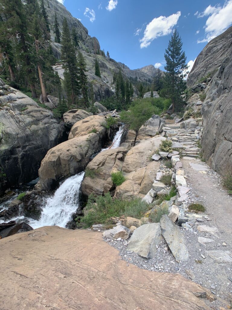
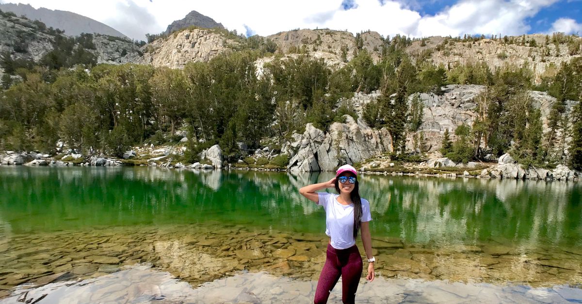
The hike from Agnew Meadows trailhead to Ediza Lake is about 7 miles and 940 ft of elevation gain. Although most of the trail is very chill, there is a section of switchbacks that are very exposed and hot to do in the middle of the day, in the middle of the summer. You can read more on this section of the hike in my Thousand Island Lake Loop blog post here.
The trail from the end of Ediza Lake to the beginning of Iceberg Lake is 0.96 miles and has 323 ft of elevation gain. The wildflowers were exploding with colors all over the trail!
Our plan was to set up camp at Cecil Lake on the first night but camped at Iceberg Lake because my partner had heat exhaustion most of the day so we moved much slower than anticipated – I even carried her pack the last mile which wasn’t so bad since she’s transitioning to ultralight hiking – learn more about how you can become an ultralight backpacker here!


Day 2: Iceberg Lake to Cecil Lake + Climbing the Volcanic Ridge 11,506 ft (3,507 m)
This was supposed to be a chill backpacking trip. Well, if you’ve been following my adventures on IG, this year I’ve been climbing… a lot. So naturally, I decided to toss in a small climbing objective into this chill trip too.
I had seen photos of the views from Volcanic Ridge – the minarets from eye-level seemed so impressive. It didn’t seem like something I could realistically climb on this backpacking trip back when I first came across it, but after these last few months and a lot of research… so much more seems within the realms of possibility.
We started this morning up a short scramble from Iceberg Lake to Cecil Lake.
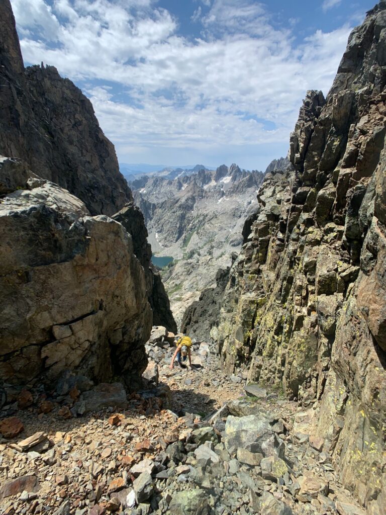
From Iceberg Lake, you can see a faint trail along the mountain to follow – this trail fades and you just follow the mountain up on the left side of the waterfall. You may not see the trail, but you’ll know where to go once you’re on the route – having some navigational cross-country (off-trail) hiking skills really help. This section is only 0.59 miles and 436 ft of elevation gain.
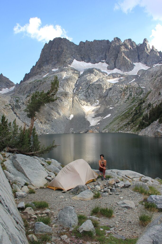
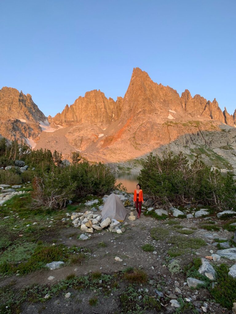
Once you reach the top, you arrive at Cecil Lake directly under the famously photogenic Minarets. We followed the east side of the lake and boulder hopped about 0.4 miles to the other end of the lake to find a flat spot to set up camp for the night, before our climb up to the Volcanic Ridge.
*Tip: it may look like slim pickin’ but don’t go for the first camp spot you see – we actually found many other cool, secluded camping spots after we pitched our tent.


After setting up camp and filtering water, we backtracked a little to start our way up towards the Volcanic Ridge at 9:36 am.
*Note: I would not recommend climbing the Volcanic Ridge via the same route we went unless you are an experienced hiker comfortable with class 4 scrambling. Otherwise, I would recommend going up and down the same way we came down near Minaret Lake which is class 2 scrambling all the way. The max slope we climbed on our route up was 63 degrees.
Also, don’t forget to look back at the Minarets during your ascent! The views are incredible
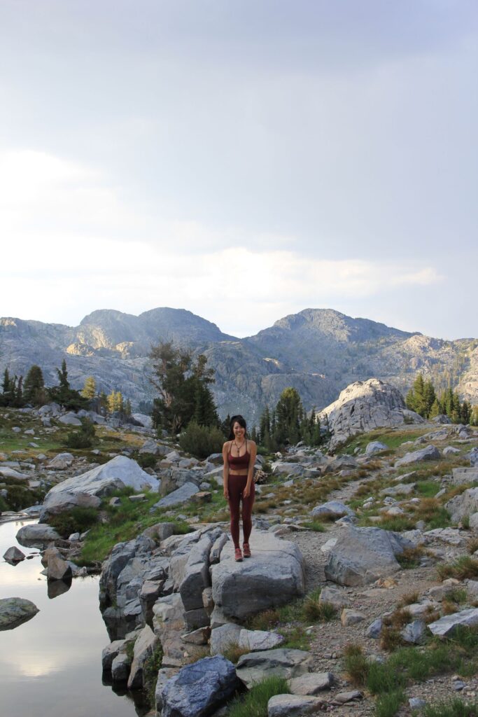
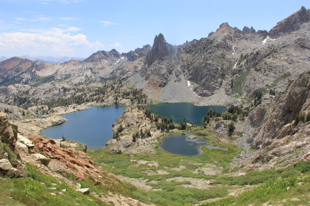
The approach to the Volcanic Ridge from Cecil Lake was beautiful, lush, and all cross-country hiking! Be sure you know how to read a topo map and navigate prior to heading out.
We picked an unconventional route up to the Volcanic Ridge – there are class 2 routes from Ediza/ Cabin Lake and Minaret Lake, and a class 4 route from the beginning of Cecile Lake. Maybe I’ve just had too much of a confidence-booster from my recent climbs, but I wanted to try the class 4 route from Cecil Lake.
We opted for something in between since my partner was a bit more hesitant to try the class 4 route due to her physical conditions from the previous day (I’ll spare you the details but it was a really bad case of heat exhaustion)- in my research while planning and preparing for this trip, I came across a track that drops right to where I needed it to, near the southeast side of Cecil Lake by the flat camp area, so this is the route we vaguely mapped out and followed.

If there’s one thing I have learned in the last few months, it’s that the mountain always looks more intimidating from further back and you have to get up close to it to analyze the route. This was true in this case as well. We knew there would be a class 2 route option if this one was too sketchy for us and Ayumi was open to scoping it out from up close… so we did!
The climb was easy class 2 scrambling for most of it but the terrain near the top definitely had many more loose boulders/ talus/ scree. The last section before making it to the top of the ridge was 105 feet of class 4 climbing – it was fun, the hand and feet holds were great, and I had a very supportive partner beneath me to help me through the heights. I’ve said this many times before, but the most important thing to have on any adventure when you’re scared of heights is to have the right support system – the right partner makes all the difference in the freaking world.


Once you reach the ridge, the summit is only a few feet away. We made it up to the top at 11:30 am, 1:19 hrs to climb up from the bottom of the scramble (0.36 miles with 799 ft of elevation gain). We were surprised to see two other guys at the top, but got to enjoy the 360 views of Ansel Adams Wilderness mostly to ourselves for an hour and a half before starting our way down.


We decided to go down the class 2 scramble towards Minaret Lake since the last section coming up scared me too much to go down the same way. Map-reading skills came in handy here again since we were heading back to Cecile Lake to camp (you can bring all of your gear and head straight to Minaret Lake to camp too, but we wanted to see the Minarets up close for sunrise). To prevent dropping down too much to Minaret Lake just to have to hike back up, we turned off around half a mile down at the first potential route that traverses back to connect to our original trail – this saved us a lot of time and mileage which we would be hiking the next day on our way out. We could hear the thunder roaring in the distance, and stopped for a photo break (thanks for helping me capture these photos in rain and hail, Ayumi!), and once the rain started coming down, we were already very close to camp. Good thing, because the hail was not far along behind it.


The thunderstorm lasted about 2 hours, in which we hung out in the tent and ate our lunch and all of our snacks, and then we got to explore the southwest side of Cecile Lake for a bit before heading to bed early. I feel like the best sunsets come after a thunderstorm…. but there was no spectacular sunset this evening.


Day 3: Cecil Lake Hike to Minaret Lake to Devils Postpile
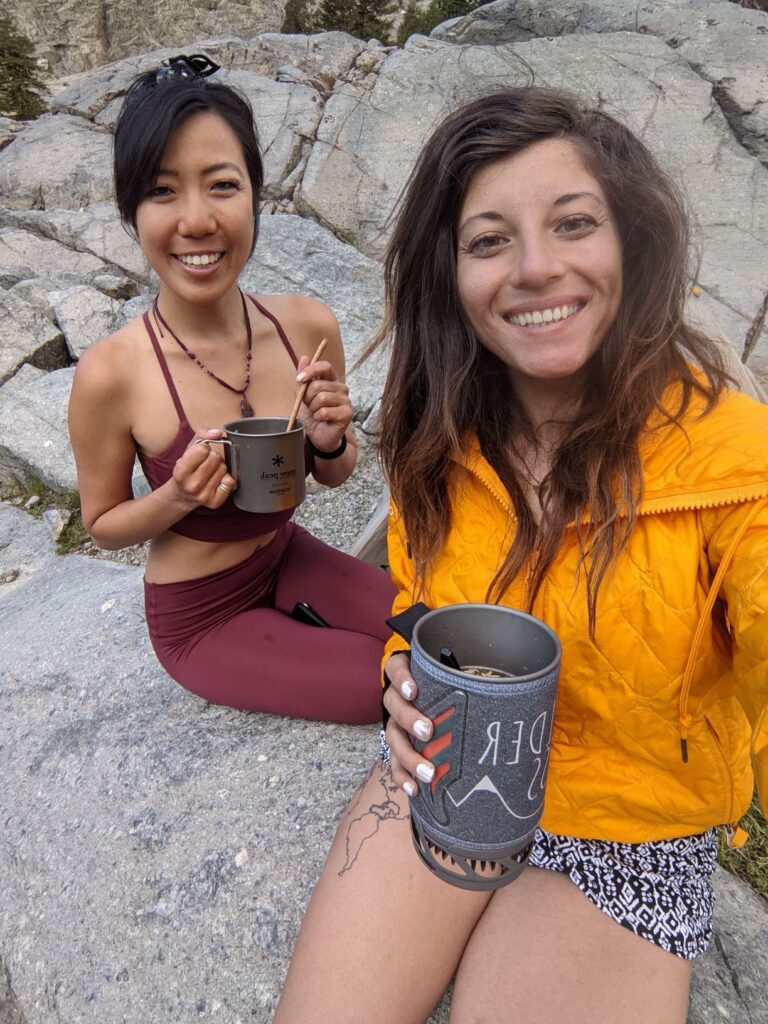
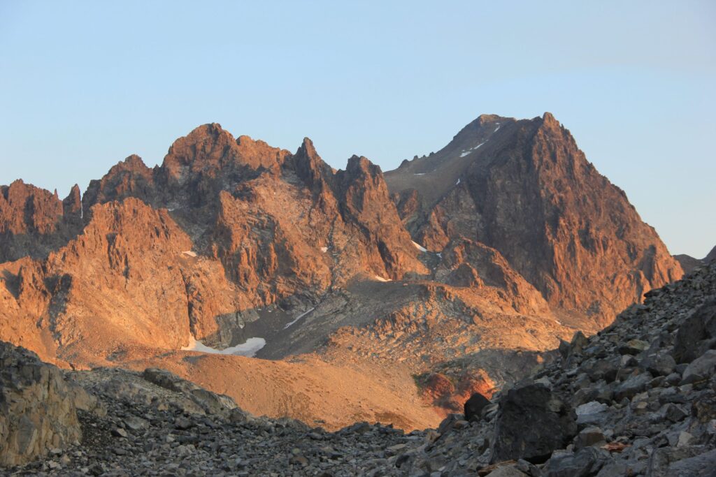
We woke up for sunrise at 5 am and caught an incredible alpenglow on the Minarets, headed back to camp for morning coffee/milk tea, packed up, and started to head down towards Minaret Lake.


The hike down to Minaret Lake takes a little bit of route finding at the beginning as well, but once you drop down to connect to the Minaret Creek Trail, it’s all easy downhill on an established dirt hiking trail.
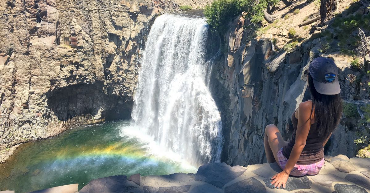
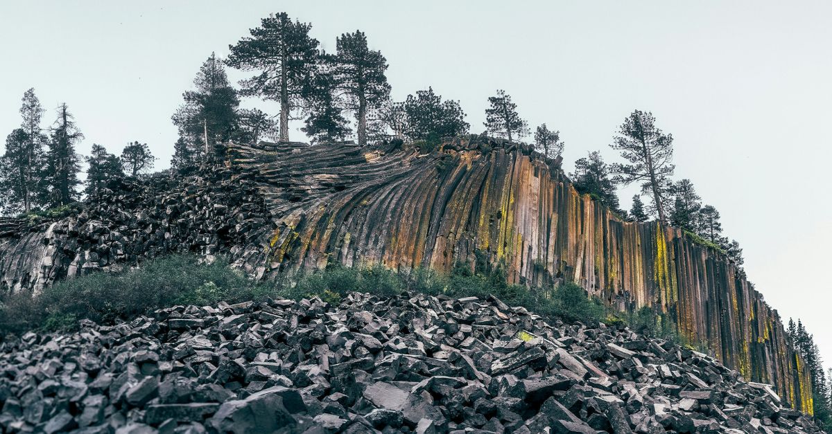
We took a morning dip in Minaret Lake because it was already blazing hot at 8 am and continued to stop at water sources along the way down to dunk our clothes to cool off. It was extremely exposed and hot by the time we arrived at the Devil’s Postpile trailhead (11:14 am) to catch our shuttle bus back to our car.
All in all, it was just under 20 miles of hiking for this 3-day Ansel Adams Wilderness backpacking loop.
Gear I Used on This Trip:
- Big Agnes 2p Tent
- Inflatable Sleeping Pad
- 30-degree Quilt
- Water filter
- Ry Mountain Gear backpack
- EB Rain Jacket
- Glyder sports bra
- Glyder leggings
- Rab Sun Shirt
- Stio synthetic insulating jacket
- Adidas Trail Shoes
- Snow Peak titanium cup for cooking
- GPS Satellite Device
From the same trailhead we started at in Agnew Meadows, you can actually loop in the opposite direction to see Garnet Lake and Thousand Island Lake - this trail was more fun in my opinion but read out the other blog post here:
Backpacking Thousand Island Lake Loop in Ansel Adams Wilderness
Thanks for reading!
I’d love to hear your thoughts – please let me know any questions, comments or suggestions in the comment box below. Don’t forget to practice Leave No Trace 🙂
This looks so AWESOME!!! I don’t know if I’ll ever do this trio but the detail you include is amazing!! The photos are amazing as always, too!
Thanks so much, Justin! The minaret lake to ediza lake loop itself (excluding the volcanic ridge climb) is definitely worth hiking when you have the time – bookmark this page for later! 😉
Hi, Tiff!
Thanks so much for your wonderful posts. It looks like we did the same two trips this year—Minaret/Cecile Lakes and Big Pine Lakes. (We camped at 5th Lake and went to the Glacier—Cloudripper next time!) What was your route down from the summit of Volcanic Ridge to Minaret Lake? I tried to get up that way but turned left too early, and ended up well below the summit. Also—love your trip report for Finger Lake. I’m hoping to get there this summer, but if not, next year!! Really appreciate your approach, descriptions, and trips. Thanks again. And happy hiking!
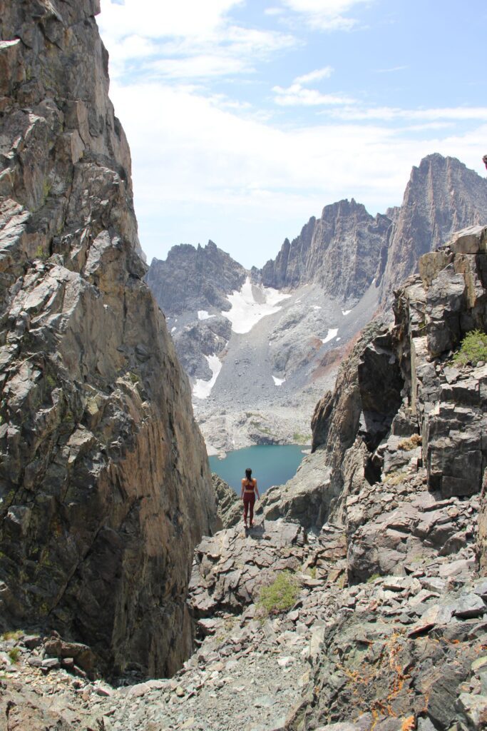
Hi NR! Thanks so much! Those are all great hikes right?! My class 2 route from Volcanic Ridge was back to Cecil Lake, but I know it’s possible to drop straight to Minaret Lake too. There’s a lower-grade gully we came down – I don’t have an image looking up at it but looking down from it, it’s the photo above with the view of minaret lakes if that helps.
Pingback: 2021 in Review: The Year of Climbing | Follow Tiff's Journey
Hi!! Loved your post and your pics. Inspired me to do a similar loop!!
I saw that the route from Edizz->Iceberg->Cecil are all offtrail and unmaintained. Would love to get your thoughts and understand how off trail was this? Was it a lot of scrambling and was it sketchy during the offtrail portions? I’ve done lots of backpacking but not a ton of off trail stuff so want to make sure I know what i’m getting myself into 🙂
Thanks!!
Hi Ashley,
Thanks so much for the kind words and I’m so happy to hear you’re getting out to Ansel Adams Wilderness – it’s one of the most beautiful areas to backpack!! There is a well-maintained trail through most of it, it’s just scrambling from Iceberg Lake to Cecil Lake. There is a faint trail you can follow which you’ll see once you reach Iceberg Lake that leads up and over to Cecil. Traversing that section isn’t too bad but when you’re going up the short section near the end, the rocks can be pretty loose so be careful 🙂
Hi!! Loved your post and your pics. Inspired me to do a similar loop!!
I saw that the route from Edizz->Iceberg->Cecil are all offtrail and unmaintained. Would love to get your thoughts and understand how off trail was this? Was it a lot of scrambling and was it sketchy during the offtrail portions? I’ve done lots of backpacking but not a ton of off trail stuff so want to make sure I know what i’m getting myself into 🙂
Thanks!!
Hi! Your page is so inspiring!!
Is there a clear trail from lake ediza to minaret lake? I’m having a hard time mapping out a backpacking route. Starting at either shawdow creek hiking to lake ediza then to minaret lake…or hike it in reverse. Any recommendations? Love this trip above but with limited time would hold off on volcanic ridge climb to shorten and make it an easier two night trip.
Thank you, Mercedes! I hiked the loop from Shadow to Lake Ediza to Iceberg Lake to Cecil Lake to Minaret Lake and it was mostly a clear trail except to/from Cecil Lake takes a little route finding, but not hard.
Hi there! Thank you for this blog! So great!
I have a permit for shadow creek and minaret lake. Trying to figure out which permit to use for a backpacking trip this weekend. Would love to hit Minaret lake, Cecil, iceberg and ediza trip. Would Would you recommend using the Shawdow creek permit or Minaret? And it sounds like you did the loop but took different shuttles not out and back?
Hi there! Thank you for this blog! So great!
I have a permit for shadow creek and minaret lake. Trying to figure out which permit to use for a backpacking trip this weekend. Would love to hit Minaret lake, Cecil, iceberg and ediza trip. Would you recommend using the Shawdow creek permit or Minaret permit to access? And it sounds like you did the loop but took different shuttles not out and back?
Wow, great hike review. I will be adding to the bucket list.
Thanks, Charlie! Enjoy the trails 🙂