HIKE TO: Telescope Peak
TRAILHEAD: Charcoal Kilns (road to Mahogany Flat closed in Winter)
ROUTE: Mahogany Flat Road > Telescope Peak Trail
MILES: 15.8 miles
TIME: 10 hrs
DATE I WENT: 1/23/22
DIFFICULTY:  moderate
ELEVATION: 11,046 ft / 3,366 m
ELEVATION GAIN: 4,075 ft
HIKE PERMIT: no
PARKING PERMIT: National Parks Pass
LOCATION: Death Valley National Park
The main difference between hiking to Telescope Peak in the Winter vs. Spring-Fall
How Do You Get to Telescope Peak in Death Valley?
The Telescope Peak trailhead will vary depending on whether you hike it in the Winter or Spring, Summer, and Fall.
- Road closure: the road to Mahogany Flat is closed in the winter (because it is icy) so you have to park farther down at Charcoal Kilns and start there. Therefore, this adds an extra warm-up to the long day.
- Elevation at Charcoal Kilns starts at 6,924 ft and the typical TH at Mahogany Flat Campground is 8,127 ft
- This road closure adds 1.63 miles (one-way) and 1,203 ft of elevation gain
- This adds 3.26 extra miles round trip.
- The Telescope Peak Trail is normally 14 miles out and back with about 3,000 ft of elevation gain according to the NPS. If you’re planning to hike this in the Spring-Fall season, this guide will not be as useful for you – I believe there is no water source on the trail so keep that in mind!
How Hard is Telescope Peak? Winter Trail Conditions Has Snow
- Telescope Peak is a strenuous hike all year round. In the summer, you have to worry about the heat. In the winter, snow is likely covering the mountain so be prepared with the proper gear!
- The snow-covered trail eliminates having to slog up any switchbacks
- So why go in the Winter? Winter is the best time to hike Telescope Peak.
- Temps are cooler as the desert gets very hot starting in April. Although the trail is at a higher altitude which has lower temperatures than the desert floor of Death Valley, it can still be warm.
- The Eastern Sierra peaks are less accessible so it’s an adventure if you’re looking to get away on a high-altitude hike.
- Also, there are so many other things you can see in Death Valley too while you’re in the area!

I’ve put off hiking Telescope Peak for so long but it’s actually a gorgeous hike & I’d recommend any experienced snow hiker to get out there now!
Telescope Peak Winter Hike Trail Report
Winter Trailhead Start
We started from the Charcoal Kilns parking lot at 7:30 am and took 50 mins to get to the official TH (Mahogany Flat Campground)… that was a bit longer than I expected with all the snow and ice on the road, but there was not enough to want to put our crampons on.
It was a sunny but very windy day with forecasts at 10-20 mph winds but felt a lot more like 30+ mph at times.
Spring, Summer, Fall Trailhead Start (Official Telescope Peak Trailhead)
After a quick snack and de-layering break, we started on the Telescope Peak trail at Mahogany Flat Campground at 8:35 am. The snow on the trail for the first two miles was a bit tricky – we weren’t wearing our crampons yet but there were little-to-no tracks to follow at a few short sections, the trail was on the mountainside which sloped downhill to the left (& I have a fear of sliding off the mountain on any snow hikes), and snow/ice so firm that I probably should have put my crampons on… but I had a hiking partner that was very comfortable hiking in the snow and patient with my slow and cautious pace (we did strap on our crampons on the way back).
Hiking to Arcane Meadows
We stopped for our first long snack break at 10:23 am just before reaching Arcane Meadows (the saddle of Rogers Peak and our trail, elevation of 9,608 ft). There’s a 0.3-mile detour to get to Rogers Peak but given the late winter start and all the snow, we just went for Telescope Peak.
This was one of those trails where I noticed I really needed to eat a snack every hour or my energy levels were depleted. Even the “easier” trails can do that to you and your body also burns calories faster when it’s cold. I also haven’t been at high altitude for a while before that which could have affected my energy as well… or maybe it was skipping dinner the night before and not eating breakfast😬

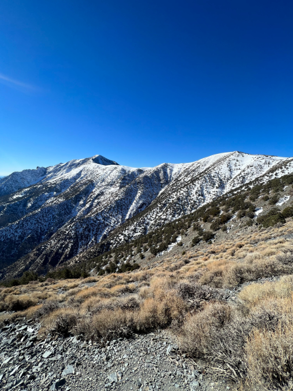
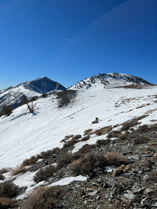


Navigating through the trees to get around Bennett Peak
Then, the trail continues downwards a little to some flat ground, then around and up the right side of Bennett Peak, before a little downwards again to the next saddle. This side of the mountain is in the shade in the morning so the snow was a bit firmer.
The elevation gain here is mellow but something I didn’t consider when planning this hike is that the snowy trail follows along the side of the mountain which makes me nervous when there’s snow. Any normal person would be ok but I was a bit anxious and moved a lot slower on those sections.
Hiking the ridge to the false summit and skipping the switchbacks
At 11:49 am, we were staring at the bottom of the ridgeline at 9,977 ft and 4.8 miles from Mahogany Flat Campground. It got slow from here for the last 1.5 mi.
When there’s snow, you get to skip some switchbacks but tread carefully as you’re on a (wide) ridge and the wrong step could send you down the side of the mountain. We strapped on our crampons at the beginning of the uphill section of the ridge. Keep in mind, there might not be tracks to follow so it’s good to have a gpx track downloaded.
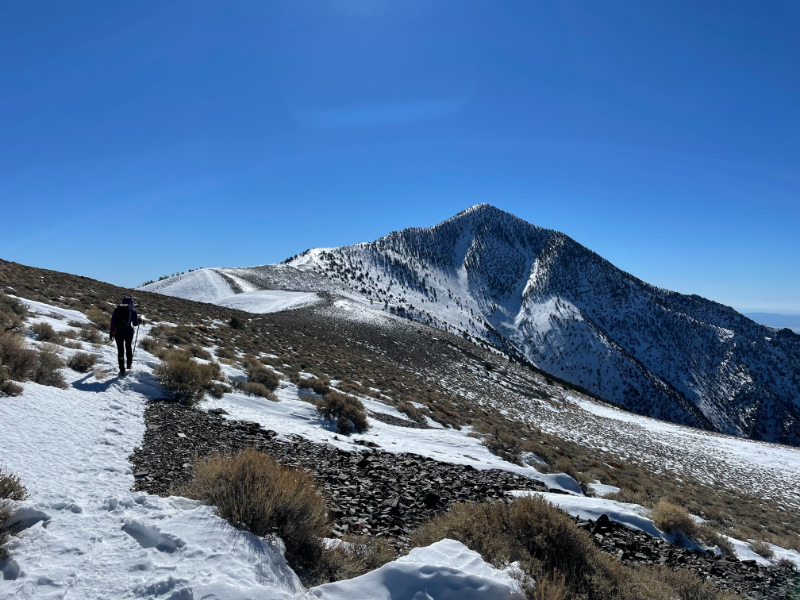


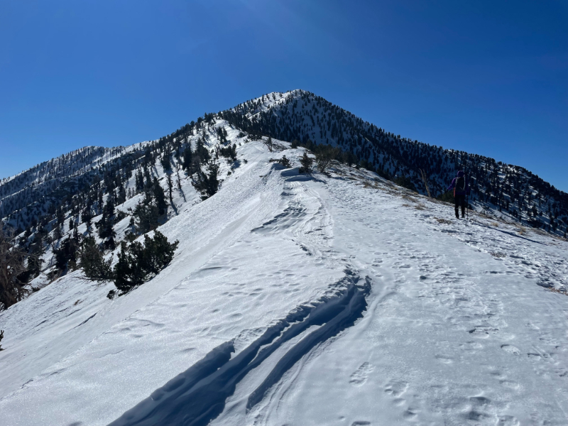
Eventually, you’re off the ridge and hiking up a mountain to the false summit. There is a false summit about 0.25 miles from the summit which sits at 11k ft.
Moving at a slow and steady pace with plenty of snack breaks and time to strap on our crampons halfway up the ridge (there was definitely an icy section before the ridge when we went), we finally reached the summit of Telescope Peak at 1:30 pm.
Tips for hiking in the snow:
*On the way up: kick your toes in first
*On the way down: dig your heels in first
*Bring hiking poles! I felt a lot safer hiking with Mark's ski pole which has an ice ax head but a regular hiking pole will do
*Bring crampons or microspikes, depending on the conditions. Yaktrax will not cut it - on our way down, we saw some Yaktrax tracks that turned around within 1-2 miles from the hike - there's a time and place for them and a big snow hike is not that time or place.
Telescope Peak Summit 11,046 ft: Highest point of Death Valley National Park
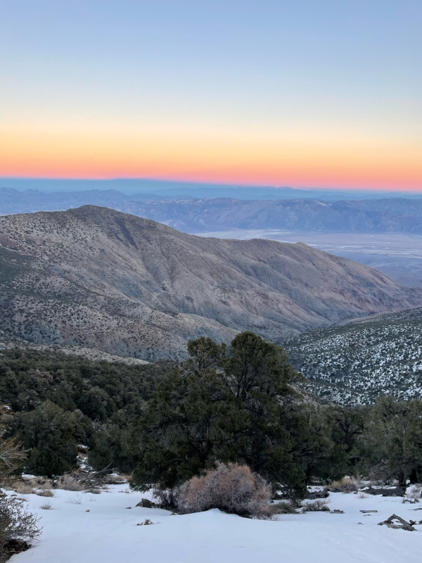
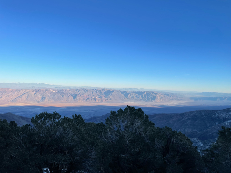
From the summit of Telescope Peak, you can look down at Death Valley National Park on one side, including the lowest point in North America, Badwater Basin, and the Eastern Sierra on the other side.


It took us 4 hours to get all the way back to the car and we got to enjoy a beautiful sunset along the way. The wind did get a lot stronger on the way back too!
*TIP* Driving to/ from LA? It’s faster to drive back through Jawbone Canyon and Trona Pinnacles than to drive through Olancha. Gas was also more expensive at Olancha than Panamint Springs which is past the Death Valley National Park sign, which was a bit surprising (as of Jan 2022)




Shop My Gear Closet for Hiking Telescope Peak in the Winter

Up to 70% Off Clearance Now!
Thanks for reading!
I’d love to hear your thoughts. Please drop any questions, comments, or suggestions below.
& don’t forget to practice leave no trace 🙂
The Wrap-Up: Telescope Peak Hike in Death Valley
Telescope Peak is the highest point of Death Valley National Park and can be hiked in the winter, although it is a strenuous snow hike and crampons are required. Prepare to add a few extra miles as you will start lower than the typical summer trailhead, Mahogany Flat Campground.
Other Posts You May Like:
Tiff, the owner and author of Follow Tiff’s Journey, is a California/ Colorado-based adventurer and outdoor connoisseur who divides her heart between the Eastern Sierra Mountains and the Colorado Rocky Mountains. Despite her fear of heights, she’s become a seasoned mountaineer, ultralight hiking and backcountry camping enthusiast, expert road trip planner, and a fervent explorer of alpine lakes, natural hot springs, and sandstone canyons.
With 10 years of experience exploring the outdoors, her blog is your go-to source for all things wilderness, offering invaluable insights and pro tips, essential gear recommendations, and awe-inspiring stories from her adventures.
Join Tiff on her quest to share the wonders of nature and inspire others to follow their own path in the great outdoors.


Very nice. If you think a 4000′ elevation gain is moderate, you’re a badass.
Thanks Larry! 4k elevation gain spread across roughly 7.5 miles isn’t so terrible I guess… but to each his own 🙂
this is not a ‘moderate’ hike—it’s strenuous compared to other hikes with this much mileage and altitude gain
Did this hike many years ago in my prime, in the summer. Beautiful wildflowers on the way to and in Arcane Meadows including Purple Sage. It was definitely on the strenuous side of moderate. I was tired, but my buddy, a little out of shape, was exhausted. I got some hot salty soup in him and put him to bed. He was even too tired to drink the ice cold beer we had waiting at our campsite. Great memories though.
Wow, I bet the trail is beautiful when the wildflowers are out! The difficulty level can vary per person but you did it!!
I lead a yearly geology hike to top of Telescope Peak with Geo-hikes, Geologic Maps Foundation. At the top is the perfect panorama to explain Basin and Range crustal extension. Of course, this is done with no snow cover so we can see the rocks. Last fall, 2021, at the top were 3 hikers who ascended from Badwater with backpacking gear, now that’s very difficult. I’m wondering if the hike from Badwater to top would be easier with snow cover given your comments about avoiding the last set of switchbacks near top of Telescope?
A geology hike out there sounds interesting – I can only imagine what you must have seen underneath all the snow!n The view higher up was actually really incredible – we even saw a gorge/ canyon-like feature but not sure what it was. Backing from the Badwater Basin (the lowest point in the US) to 12k ft is definitely a huge workout – that’s awesome to hear people doing it! I think snow hiking is always nice to eliminate switchbacks as you create your own trail, but snow also poses a different level of experience and gear so one must properly know how to use that set of gear that differs from regular 3-season hiking.