HIKE TO: Inspiration Point, Muir Peak, Echo Mountain Ruins, Mount Lowe Railway
TRAILHEAD: Cobb Estate on Lake Ave
TRAIL: Sam Merrill Trail > Castle Canyon Trail > Muir Peak Rd & Muir Peak Trail
MILES: 12 miles
TIME: 5 hrs
DATE I WENT: 3/8/15
DIFFICULTY: moderate
ELEVATION: 4,593 ft
ELEVATION GAIN: 3,225 ft
HIKE PERMIT: no
PARKING: residential street parking
LOCATION: Altadena, Southern California
In March 2015, I explored Echo Mountain and Mount Lowe Railway for the first time, then hiked to Inspiration Point and Muir Peak in the San Gabriel Mountains of Los Angeles. This is a 10-mile loop hike to Inspiration Point from Castle Canyon to Sam Merrill Trail if you do not want to add on Muir Peak, but Muir Peak from Inspiration Point is very close and a relatively flat hike. There is a lot of history to see on this hike with the Mount Lowe railway ruins, as well as many trail options so read on for my detailed experience!


Where is Echo Mountain located?
Echo Mountain hike is located on the edge of Altadena, California, in the San Gabriel Mountains of the Angeles National Forest. The Echo Mountain Ruins is located at the end of the old Mount Lowe Railway route and can be accessed by a hike on Lower Sam Merrill Trail.
The Echo Mountain to Inspiration Point hiking trailhead starts at Cobb Estate at the north end of Lake Ave in Altadena, CA. There is street parking which was already pretty full by the time we got there at 7:40 am, but we found a spot further down. This is a very popular trailhead.
The actual Sam Merrill trailhead to Echo Mountain is through the gates of Cobb Estate, but instead of continuing on the main road towards Altadena Crest Trail, you will find a dirt trail and sign at the end of the straight path. Take this trail.
How long is Echo Mountain Hike?
The hike to Echo Mountain ruins is 2.5 miles one way from the trailhead with about 1,370 ft of elevation gain. This should take about an hour one way if you’re moving at a faster pace.
How do you get to Inspiration Point?
Inspiration Point is a scenic viewpoint located near the top of Echo Mountain in the San Gabriel Mountains near Pasadena, California. The point offers breathtaking views of the Los Angeles Basin and surrounding mountains.
From Echo Mountain, you can hike the Sam Merrill Trail to Inspiration Point or the Castle Canyon Trail. I’d recommend hiking both trails and creating a lollipop loop for a nice 10-mile day hike (including the round-trip hike up to Echo Mountain). It’s more common to hike up Castle Canyon Trail and down middle Sam Merrill Trail, but I recently hiked it in reverse and enjoyed it as well.
How hard is the hike to Inspiration Point?
The hike to Inspiration Point is a 10-mile loop with 2,690 ft of elevation gain. It’s a moderate-level hike for all ages but for a beginner hiker, the longer distance can be more taxing. I’d recommend giving yourself a minimum of 5-7 hours depending on your pace. I am relatively fit and find 5 hrs of moving time to be sufficient, but take time to enjoy the viewpoints and history as well.
The hike is usually dry and doesn’t get snow, but once in a blue moon during a big storm like the current one in SoCal, snow reaches low elevation but it will melt quickly too. If you’re going in the next few days from early March 2023, expect the Sam Merrill Trail before Inspiration Point to be icier as it is in the shade.


Outfit by Glyder; Hiking boots by Eddie Bauer
Trip Report: Sam Merrill Trail to Echo Mountain, Castle Canyon Trail to Inspiration Point, and Muir Peak
On Sunday, March 8, 2015, at 7:45 am, my friend and I hit the trail to Inspiration Point. I just got a new day pack I was excited to try and had not done too many 10+ mile hikes at the time so I was eager to get out, explore, and test my physical abilities.
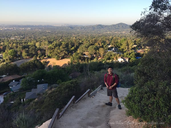
We started on the Sam Merrill Trail to Echo Mountain and the Mount Lowe Railway Ruins. In the Winter and Spring, the trail is very vibrant green and even has a little bit of wildflowers along it. The trail starts flat but quickly ascends on a narrow dirt trail along the side of the mountain with long switchbacks. There are a few very small benches along the trail if you need to take a break and enjoy the views.


In 2.5 miles, you reach the Mt. Lowe Railway Trail that connects Echo Mountain Ruins on one end and Mount Lowe Motorway (wide fire road) on the other end. From t Mount Lowe Motorway, you can access Dawn Mine further down but for this hike, do not go that way.
Continue straight to the end and you will arrive at Echo Mountain Ruins. This is a good spot for a longer break if needed and some people choose to simply hike here and back down. We took 20 mins to enjoy the views of Los Angeles and the ruins, and fuel up for the next portion of the hike to Inspiration Point.
After you are done exploring the historic site, head back in the direction you came and there are several trail options. They all lead to Inspiration point, but Castle Canyon trail is the shortest hike up so we went up that and down Sam Merrill.


Echo Mountain to Inspiration Point Loop Hike
From the Echo Mountain Ruins, we traced our steps back about 500 ft and began our hike up to Inspiration Point via Castle Canyon Trail. The trail starts off exposed to the sun and is fairly flat, but then it is mostly shaded in the trees with 1,337 ft of elevation gain in 2 miles to Inspiration Point. Parts of the trail get narrow and it is also near water flowing down if you go after it rains.


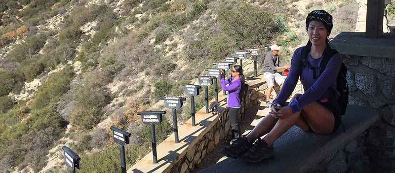
2 miles from Echo Mountain, we reached Inspiration Point on Muir Peak Road. Inspiration Point was named for its inspiring views of the Los Angeles Basin and San Gabriel Mountains. It was a unique site but definitely crowded. The “telescopes” are just pipes, but it is still a neat idea.
We took another break here for an early lunch and witnessed an older mountain biking couple renew their vows. This was the last break and we left here around 11 am for Muir Peak.


Hike to Muir Peak
From Echo Mountain, the common destination is Inspiration Point (4,524 ft). Not too many hikers make the detour to Muir Peak (4,628 ft) which meant it was quiet and secluded for us. You can also access many other small peaks from Inspiration Point such as San Gabriel Peak, Mount Lowe, Mount Disappointment and others, but this requires going deeper into the mountains which was not our intention for this trip.
There are no trail signs, but the trail continues on the fire road (Muir Peak Rd) to your right (when you get up from Castle Canyon Trail, make an upwards u-turn).
We did not see a single person here.
This trail looks different than the rest of the hike so far because it is a road covered with some grass but it still has a clear walking path. You should see the trail marker for Muir Peak in around 0.7 mile. Keep an eye out for it as it is hidden to the right and the trail starts ascending a little bit. Once you reach the summit of Muir Peak, you can clearly look down at San Gabriel Valley and even see Mount Wilson!
The total distance from Inspiration Point to Muir Peak is about 1 mile, one way. When you are done enjoying the solitude at Muir Peak, head back towards Inspiration Point to continue the loop hike down to the trailhead via middle Sam Merrill trail.


Hiking down on the Sam Merrill Trail from Inspiration Point to Echo Mountain and Cobb Estate/ Lake Ave Trailhead
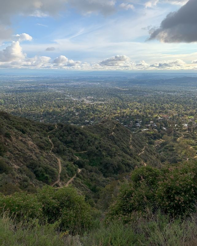
Continuing on the other side of Inspiration Point, follow the wide fire road until you reach the middle Sam Merrill Trail. The trail starts off shaded along the back side of the mountain for just under a mile before it wraps back around to the front of the mountains and you are greeted with more open city views of Los Angeles. After a really big storm, expect some fallen tree obstacles along the trail.
The middle Sam Merrill trail connecting Echo Mountain and Inspiration Point is 2.5 miles + 0.5 miles on the fire road leading up to it so the overall elevation gain going down was less hard on the knees than the Castle Canyon trail up to Inspiration Point..
There are mountain bikers on this trail that fly down the shared trails so be mindful of that.
About 0.2 miles before reaching the junction to Echo Mountain on the hike down is the Observatory Ruins which had a refracting telescope, considered to be one of the largest and most advanced telescopes of its time in the early 1900s.
The telescope was used for astronomical research and observation for several decades, but unfortunately, the Mount Lowe Observatory fell into disrepair and was eventually abandoned in the mid-20th century. While the telescope itself is no longer operational, the ruins of the observatory, including the telescope, can still be seen today and visited as a historic site.
Once you reach the trail junction for Echo Mountain, you are only 2.5 miles from the trailhead! We arrived back to the car by 1:45 pm, leaving half the day open for adulting.


Reflecting moment: When I hike with other people, I don’t bring headphones. It bothers me when other people play music through speakers because it disturbs the peace. Sometimes I like to talk during a hike, and sometimes I just enjoy the peace and solitude even if I am hiking with a friend. My mind never shuts off — I always have a million thoughts running through my head all day everyday, but when I hike… there’s just something about it that makes me not think about a single thing except watch your step, don’t trip! THAT I think is one is my favorite things about hiking. I realized clearing my head comes naturally to me. & I appreciate the moment and the day so much more.
Other Hikes Near Los Angeles You Might Like
Tiff, the owner and author of Follow Tiff’s Journey, is a California/ Colorado-based adventurer and outdoor connoisseur who divides her heart between the Eastern Sierra Mountains and the Colorado Rocky Mountains. Despite her fear of heights, she’s become a seasoned mountaineer, ultralight hiking and backcountry camping enthusiast, expert road trip planner, and a fervent explorer of alpine lakes, natural hot springs, and sandstone canyons.
With 10 years of experience exploring the outdoors, her blog is your go-to source for all things wilderness, offering invaluable insights and pro tips, essential gear recommendations, and awe-inspiring stories from her adventures.
Join Tiff on her quest to share the wonders of nature and inspire others to follow their own path in the great outdoors.


