HIKE TO: Split Mountain
TRAIL: Red Lake Trail
TRAILHEAD: Red Lake Trailhead (requires 4wd)
MILES: 11.1 miles
TIME: 2 days / 1 night (14 hrs / 11.5 hrs moving time)
DATE I WENT: 7/17/21 - 7/18/21
DIFFICULTY: moderate - requires class 2 scrambling
ELEVATION GAIN: 7,349 ft
HIKE PERMIT: yes for overnight camping, no for day hikes
PARKING PERMIT: no
CAMPFIRES: NOT ALLOWED - please practice leave no trace
LOCATION: Eastern Sierra, Inyo National Forest
We decided to hike to Split Mountain as an overnight trip because I have heard Red Lake is beautiful to camp at and the trail to Split Mountain is steep and brutal, but this can be done as a day hike too.
Day 1: Hike to Red Lake and backcountry camp
Day 2: Climb the North Slope up to 1 of California's 15 fourteeners, Split Mountain
Day 1: Hiking to Red Lake in Eastern Sierra Mountains
Even though we started early-ish in the morning at 6:50 am, it was ridiculously hot! There are two ways to start the Red Lake trail from the parking lot – we followed the common route which starts off to the right of the parking lot area. This trail is extremely exposed and steep, climbing 3,842 ft in 3.78 miles from the trailhead to Red Lake. There are barely any water sources or shade – aside from the first and only other lake (3.3 miles in) you pass on the hike to Red Lake, there was a little bit of water running from Red Mountain Creek along the trail. It’s muddy in this area (the only really shaded tree area on the trail) and although it may seem dirty to filter from, there are areas to catch some clean-ish water flow so we managed to filter water on the hike.
I was extremely hot and winded from this hike. To be honest, it took a LOT more out of me than I expected it to. I was the weak link in the group for sure that day. I felt like I had to stop at every other switchback going up. I’m embarrassed to say just how terribly I did… but I’m only human and we all have our bad days.


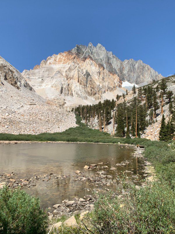

The trail can be a bit hard to follow but if you have a good sense of direction and know how to route find, you’ll be fine. It also helps to download a gpx route for Split Mountain beforehand for guidance.
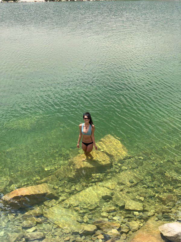
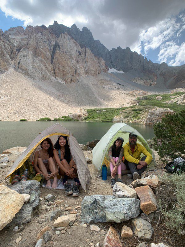
At 11:28 am, we arrived at camp at Red Lake much earlier in the day than I have ever arrived at camp. With 8 hours of daylight, what would you do? We probably had enough time for a late afternoon summit that day, but instead, we spent the entire day hanging out at camp and the lake, being lazy, resting, eating all the extra snacks we packed, and getting a wee bit antsy to summit the next morning.




Day 2: Climbing to Split Mountain Summit
From camp, you can’t see the full route to Split Mountain summit but start by aiming for the saddle above the highest grass area. Starting at 5:20 am, we quickly made our way up towards the saddle, catching a breathtaking sunrise with the alpenglow lighting up the mountain range of our objective. This day was all cross-country hiking (hiking off-trail requiring route finding) and all boulders/ screes/ talus/ scrambling/ rocks. When you’re almost at the top of the saddle, I found the ground to be more stable along the right side with good holds. Some of my friends stayed towards the left just before reaching the saddle and it seemed much looser. The approach to here was 5.12 miles with 5,778 ft of elevation gain (from the trailhead).
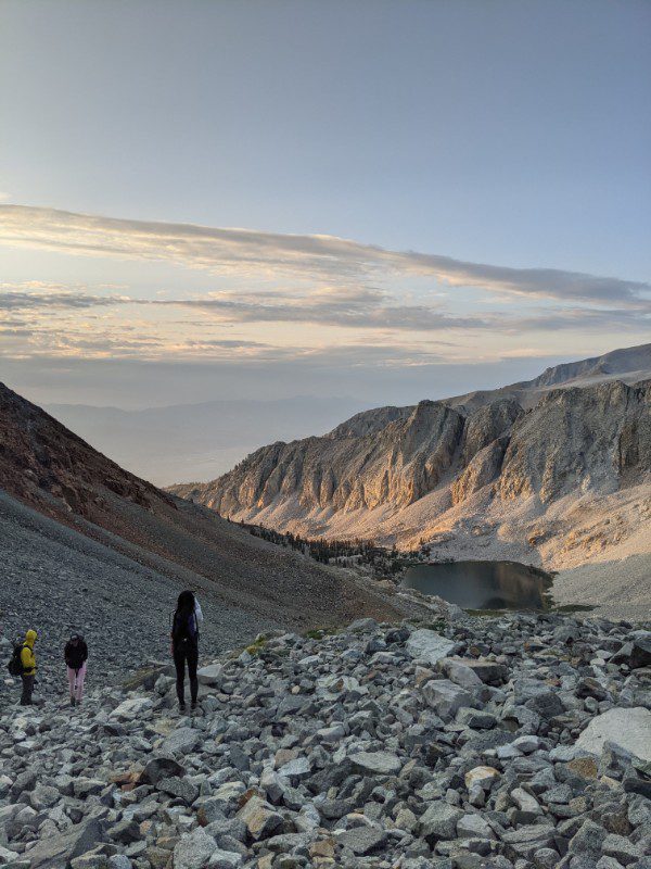


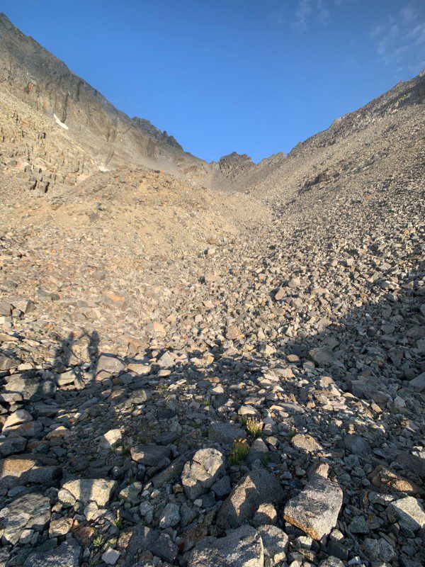

Once you reach the top of the saddle, the fun part begins – the North Slope along the ridge. This is supposedly the sketchy harder section but I found the approach to the ridge, through the class 2 scramble to be more miserable than anything else.
The talus slope has a steep drop-off on one side but it’s very wide and easy to walk on. The dirt is a bit loose, as well as some rocks, so be mindful of your steps.


Once you reach the top of the ridge, it’s a short (but seemingly never-ending) easy scramble to the summit of Split Mountain. We started here at 5.29 miles and 6,278 ft of gain (from the trailhead), now reaching 12,950 ft at 8:11 am. There is a loosely worn trail to start that disappears along the way, but just aim for the summit! Note that you don’t want to start off going too high towards the left because there is a drop-off between Split Mountain peak and another peak in front of it.


We made it to the summit of Split Mountain by 9:08 am, 5.76 miles, and 7,349 ft of elevation gain from the trailhead.


Glad to have knocked out another 14er with an amazing group that’s great at communicating – this is very important when you’re doing scrambles so you don’t send rocks down on one another.
The rain came shortly as we started heading back down. It was light, but it lasted the entire day until maybe the last mile or two before getting back to the car.


Thanks for reading!
I’d love to hear your thoughts, questions and comments below! & please don’t forget to practice Leave No Trace!
Never Miss a Post:
Other Posts You May Like:
Tiff, the owner and author of Follow Tiff’s Journey, is a California/ Colorado-based adventurer and outdoor connoisseur who divides her heart between the Eastern Sierra Mountains and the Colorado Rocky Mountains. Despite her fear of heights, she’s become a seasoned mountaineer, ultralight hiking and backcountry camping enthusiast, expert road trip planner, and a fervent explorer of alpine lakes, natural hot springs, and sandstone canyons.
With 10 years of experience exploring the outdoors, her blog is your go-to source for all things wilderness, offering invaluable insights and pro tips, essential gear recommendations, and awe-inspiring stories from her adventures.
Join Tiff on her quest to share the wonders of nature and inspire others to follow their own path in the great outdoors.


Wow—quite an adventure and soooooo much elevation gain!!! You can’t be so hard on yourself by being winded on this type of hike—–that was tougher than tough!!
It’s definitely a lot of elevation gain and it’s the kind of trail that you take one step forward and half a step back :\
Always a pleasure reading your posts about your hiking adventures. Your fantastic Tiffany.
Thanks for following along, Harv!
4WD THE ROAD GOING UP! ONLY HAVE SMALL CAR CANT GO.
High clearance vehicle is definitely helpful, maybe find a carpool?
Admittedly, I have never been to this trailhead. But there are a couple of things to keep in mind. First of all, I have been to some pretty crazy places in an ordinary sedan – places most people would say are impossible. Sometimes, all it takes is taking things slowly, stopping before rough spots to look things over before proceeding, knowing the right path to take through rough spots, and occasionally getting out of the car to move things. Traveling light helps as well, as your suspension will be less loaded down, which increases ground clearance.
Of course, there is always the possibility you just can’t make it. But maybe you can make it within half a mile of a mile. This isn’t unreasonably far from the trailhead – you can just park here and hike the rest of the way.
Of course, the whole idea of carpooling was brought up. And this is a possibility. But if you don’t know anyone who hikes, is up to a hike of this magnitude, or you just want to hike alone, you might see if someone might lend you a vehicle capable of making it to the trailhead.
Hi Matt,
Thanks for your message, really appreciate the tips for my readers! Definitely agree with your outlook on “small cars” making it through rough dirt roads where one wouldn’t think it to be possible – I’ve certainly made it to a few I didn’t think I would as well. But let’s assume the average person doesn’t know how to handle those roads and I wouldn’t want someone to get stuck based on my recommendations they can make it in an ordinary sedan and expect a normal ride. From what I recall though, this road would be pretty rough to do in a low-clearance car.
Props to you and crew. I turned back due to conditions but am gonna try again next year. Also I could not find the road to the trail head. Will you please share directions, thank you.
Hi Darren, sorry I missed your message! I don’t recall the directions as my friend drove for this one but Red Lake Trailhead does pop up on Google Maps.
Hey Tiff
Great pics! We attempted Split Mtn last year but had to turn back due to weather conditions. I was wondering which route you drove to the trailhead. We took the route where a dirt road split off Glacier Lodge Rd out of Big Pine but this was a rather long and arduous route.
We are thinking of trying the route that heads west right off the 395, through the Tinemaha Campground.
After reading your trip report, I am so looking forward to bagging this peak.
Thanks!
Hi Jason,
It’s been awhile and I wasn’t driving on this trip so I’m sorry I don’t remember which way we drove to the trailhead. I just remember it was a long and very bumpy ride… best of luck on your return trip!