California 14ers:
What is a 14er? How many 14ers are in California?
There are 15 peaks in California that rise above 14k ft, but only 12 of them are considered true 14ers.
A fourteener is a mountain with a summit elevation of at least 14,000 ft.
A peak is classified to have at least 300 ft of topographic prominence (the measure of high how the summit rises above its surroundings) which Polemonium Peak, Starlight Peak, and Thunderbolt Peak (all in the Palisade range) fall short of, but the climbs are worth it.
California 14ers listed in the order I hiked/ climbed the mountain for the first time
- Mount Whitney 14,505 ft
- White Mountain 14,252 ft
- Mount Shasta 14,179 ft
- Mount Sill 14,153 ft
- Split Mountain 14,058 ft
- Middle Palisade 14,019 ft
- Mount Russell 14,086 ft
- Mount Muir 14,018 ft
- Mount Langley 14,032 ft
- Polemonium Peak 14,080 ft
- North Palisade 14,242 ft
- Starlight Peak 14,200 ft
- Thunderbolt Peak 14,003 ft
- Mount Tyndall 14,026 ft
- Mount Williamson 14,380 ft
California 14ers description summaries below rated by difficulty: easiest to most challenging, and how enjoyable I personally think it is, including technical/non-technical details
I summited some of these 14ers as regular day hikes, some as overnight backpacking trips, some as mountaineering objectives, and some as alpine rock climbs, so my list may vary from the standard list of people who climb the easiest routes, but I’d like to think I climbed some of the best/ classic routes and highly recommend the trails/ routes I’ve done if you have the experience or guide to do so.
The difficulty ranking all comes down to personal preference so what I think may be easier, you may not. I maintain my fitness levels year-round and my summaries below are for someone of decent hiking shape, and totally achievable to anyone willing to train, just as I did to start. I also added a label of hike or technical, hike indicating there’s a normal hiking trail, and technical indicating scrambling/ climbing/ mountaineering and the need for some sort of mountaineering or climbing gear (and of course, proper use of how to use them).
Click here to download your California 14ers printable checklist.
For more details and route options on climbing peaks in the Sierra Nevada, check out Secor’s The High Sierra – it’s the guidebook I use.

White Mountain
14,252 ft
June 27, 2020
Route: White Mountain Trail
Difficulty: Moderate Hike
White Mountain is the easiest hike of all the California 14ers because there is little elevation gain, it’s just long. It’s a bit of a drive off the 395 and the trailhead can be accessed by AWD cars. This hike is unique and beautiful because it offers very different views than all of the other CA 14er peaks since it’s in the White Mountain Range, so you’re looking across at the Eastern Sierra from the summit. There’s also cell service up at the summit and I hear the trail is always windy.

Mount Whitney via Whitney Trail
14,505 ft
August 25, 2015
Route: Mount Whitney Trail
Difficulty: Moderate Hike
The Whitney Trail is absolutely beautiful and best done as an overnight hike for your first time so you can enjoy the views and acclimate if you’re not used to high-altitude hiking. Hiking Mt. Whitney is no walk in the park but if you put in the work and train for it, it can be just as easy for you as well.
The mountaineer’s route is more challenging for the average hiker and requires knowledge and proper use of ice ax and crampons.
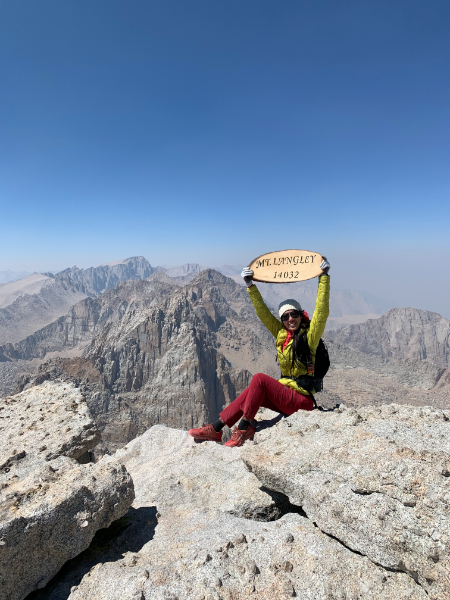
Mount Langley
14,032 ft
August 21, 2021
Route: New Army Pass
Difficulty: Moderate Hike
The hike to Cottonwood Lakes is beautiful, but the last 3 miles after New Army Pass was a slog. It was long and all boulders. I used to think Mt. Whitney had the longest two miles of your life, but Mt. Langley felt longer to me.
Mount Langley vs. Mount Whitney: They’re physically close in the Sierra Nevada mountain range and probably two of the more commonly sought-after beginner-friendly CA 14er hikes. Most people will say Langley is easier than Whitney due to the difference in elevation gain, but I ranked the Whitney Trail as easier than Langley because of the terrain. Langley has a lot of boulders/ sand at the end (Whitney does too but it’s a clear, flat-ish trail for most of that), but Whitney does have significantly more overall elevation gain so keep that in mind. Whiney just has more variety of beautiful views throughout the hike which made it more enjoyable as well, but the summit views from Langley beat Whitney in my opinion.

Mount Muir
14,018 ft
August 15, 2021
Route: Mt Whitney Trail
Difficulty: Moderate Scramble
Climb Mt. Muir when you hike Mt. Whitney! I tagged Whitney for the 5th time just so I could come up Mount Muir… I’ve thought about it on previous trips but was honestly too scared, lacking off-route trail finding experience before, and it didn’t seem worth it at the time. After I set my eyes on knocking out all CA 14ers, I had to return to the hike that started it all and finding my way up to Mt. Muir was easier and shorter than I expected. As long as you know where to turn off & where the peak is (do your research ahead of time), it’s easy-moderate scrambling off Trail Crest and relatively short.

Mount Shasta
14,179 ft
April 16, 2021
Route: Avalanche Gulch
Difficulty: Easy-Moderate Mountaineering
Avalanche Gulch is a winter mountaineering route, totally doable for beginners who know what they’re doing. It’s not technically hard, it’s just a lot of elevation gain and long. I can’t imagine it to be fun slogging up the huge talus/ scree-field when there’s no snow so time it with the Spring snow season if you know how to use ice ax and crampons, or find a different route up.

Split Mountain
14,058 ft
July 18, 2021
Route: North Slope
Difficulty: Moderate; Non-technical hike with class 2 scramble at the end
Split Mountain is not technically difficult, but I personally struggled a lot with the hike to Red Lake – it was hot, a lot of ups and downs and sand, and just one of those days. The scrambling after Red Lake was fun and chill! The trail has little tree coverage, requires cross-country hiking and good navigation skills.
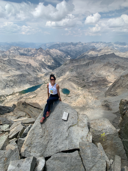
Middle Palisade
14,019 ft
July 25, 2021
Route: Northeast Face
Difficulty: Moderate Class 3 Scramble
This one is fun and the scrambling section is a lot shorter than I expected. The hike to Finger Lake is a bit more strenuous but it’s a great spot to camp before if you have permits. The red rock section had some loose rocks so be mindful of your surroundings.
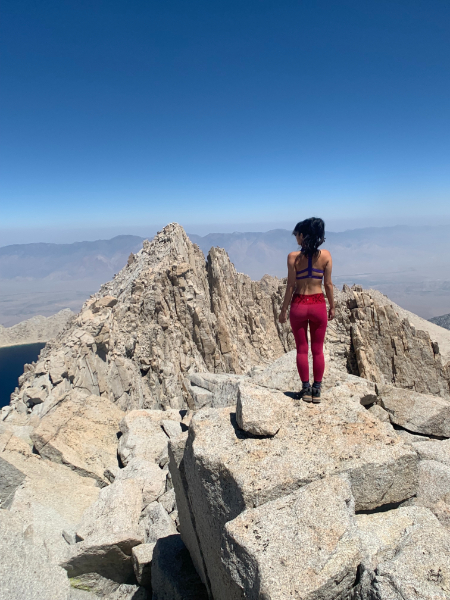
Mount Russell
14,086 ft
August 8, 2021
Route: East Ridge
Difficulty: Moderate Class 3 Scrambling
The East Ridge of Mount Russell is said to have the finest rock in all of the Sierra… and I definitely agree! The trail to the top of Russell-Carillon Pass sucks and it’s a long day, but the ridge is fun, fully exposed, and adds a bit of excitement if you’re scared of heights like me. You’re able to stay just off to the right side of the tippy top of the ridge if you’re not comfortable with the ridge.

Mount Tyndall
14,026 ft
October 16, 2021
Route: North Rib / Northwest Ridge
Difficulty: Moderate Class 3 Scramble
Tag this one with Williamson. Shepherd Pass is long but after the first three miles of uphill hiking, it was easy hiking to reach the pass.
The approach from the top of Shepherd Pass was short. We scrambled a mix of the North Rib and the Northwest Ridge route – we may have gotten on a different rib too early to connect with either the NW Ridge or the summit ridge, and came down the North Rib but whatever we did, it was easy to find a way up to the ridge from the class 3 side. The entire climb was faster and easier than expected. The summit ridge is really fun and not too long.
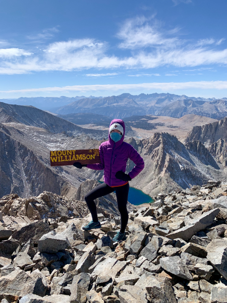
Mount Williamson
14,380 ft
October 17, 2021
Route: West Face
Difficulty: Moderate Class 3 Scrambling
Mount Williamson is the second highest peak in California. From the top of Shepherd Pass, it takes a bit of route finding through the Williamson Bowl to reach the bottom of the gully. There are a lot of dead-end chutes on the West Face of Williamson so do your research ahead of time. The chimney isn’t hard if you’re an experienced climber. After getting above the chimney, there is still a short bit of traversing and scrambling to reach the peak but it’s relatively easy boulder hiking from that point. Overall, it’s a long one but not technically challenging.
Palisade Traverse blog is coming – subscribe to my newsletter to be notified of new blog post alerts.

Polemonium Peak
14,080 ft
October 3, 2021
Route: Palisade Traverse
Difficulty: Challenging Technical Climbing
We did the Sill to Thunderbolt Traverse which made it easier to summit all 5 14ers off of the Palisade Crest. From East to West, the peaks include:
- Mount Sill
- Polemonium Peak
- North Palisade
- Starlight Peak
- Thunderbolt Peak
Our approach to Polemonium Peak was from Mt Sill, and Polemonium was the easiest and shortest of the 5 peaks to reach.

Mount Sill
14,153 ft
I’ve done both a snow and rock route for Mt Sill… neither was easy, and the Glacier Notch on the approach from Big Pine Lakes/ Palisade Glacier was loose and challenging for me, both in dry conditions and with snow. In fact, I almost turned around at that point both times because I was scared with no rope… and eventually got on rope both times.
May 7, 2021
Route: North Couloir
Difficulty: Moderate-Strenuous mountaineering + Class 3-4 scrambling
The couloir is short and easy but the climb doesn’t stop there. There is a traverse in the snow after to reach the class 3-4 scramble section that is a bit exposed. I found this scramble to be more challenging with snow present in my crampons.
October 2, 2021
Route: Swiss Arete
Difficulty: Technical Rock Climb 5.7
The rock quality is good so the climb was mostly not challenging, but there is one section right before the crux that is extremely exposed and scared the living crap out of me. As someone terrified of heights – I feel the need to warn you about this. If you trust your lead partner, don’t think – just go. You’ve made it that far and you’re not turning around anyways so take the leap of faith. Will write about this more on my upcoming Palisade Traverse blog.
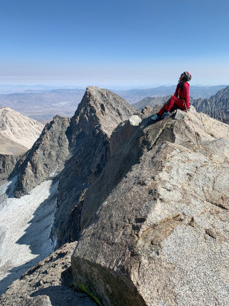
North Palisade 14,242 ft
October 3, 2021
Route: Palisade Traverse
Difficulty: Technical Rock Climb / 5.6 chimney
North Palisade is the 3rd peak on the Palisade Traverse. The chimney climb was fun and easy if you’re a rock climber.

Starlight Peak
14,200 ft
October 3, 2021
Route: Palisade Traverse
Difficulty: Technical Rock Climb 5.6
The milk bottle was a bit terrifying. It’s not very tall but when you’re rock climbing at 14k ft, any amount of exposure raises caution for safety.

Thunderbolt Peak
14,003 ft
October 4, 2021
Route: Palisade Traverse
Difficulty: Technical Rock Climb 5.8 -5.9
The summit block is 5.8-5.9 and the hardest of all California 14ers. I honestly struggled. Everything about it scared me once I was on the summit block; all of my fear of heights and irrational fears of swinging like a pendulum came flooding back to me. I needed help getting up and I’m not ashamed to admit it! I only started rock climbing a few months before this and it was hard climbing for me, even on top rope. The scramble approach was not technically hard but there was a steep climb from the saddle between Starlight and T-bolt, and the summit block was challenging – my partner chose to tackle it from the arete in the back right (in photo) which I believe is less common and more exposure, and I went up the right face of the wall.
Which California 14ers have you hiked?
Have any questions? Drop a comment below!
Booking travel soon?
Please consider using my affiliate links below. It costs nothing additional for you but helps me maintain the ever-increasing costs of running a travel blog:
General travel through Tripadvisor here.
Book your flights here.
Book your accommodations here on Expedia, Booking.com, Hotels.com, and VRBO.
Book your car rentals here.
Book your tours here.
Book your travel insurance here.
Shop my favorite gear here.
Tiff, the owner and author of Follow Tiff’s Journey, is a California/ Colorado-based adventurer and outdoor connoisseur who divides her heart between the Eastern Sierra Mountains and the Colorado Rocky Mountains. Despite her fear of heights, she’s become a seasoned mountaineer, ultralight hiking and backcountry camping enthusiast, expert road trip planner, and a fervent explorer of alpine lakes, natural hot springs, and sandstone canyons.
With 10 years of experience exploring the outdoors, her blog is your go-to source for all things wilderness, offering invaluable insights and pro tips, essential gear recommendations, and awe-inspiring stories from her adventures.
Join Tiff on her quest to share the wonders of nature and inspire others to follow their own path in the great outdoors.

Notable thing about Langley is that last portion only has 2 rocks to climb over which reveals the trail. You must follow the cairns then you avoid having to climb over boulders for an hour. This makes Langley significantly easier than Whitney.
As you approach the boulder field, go all the way to the left and continue left.
Additionally, on way back last 5mi are a breeze compared to Whitney which destroyed our knees. Langley only took 5h down vs Whitney 8h.
Thanks for the message, Yura. To each her own – As I mentioned, my ratings are based off of my own experience and I know most people rate Langley as easier – maybe I just had an off day. I personally just found Whitney more enjoyable as well.
Why don’t you wear clothes?
Haha that’s funny cause it looks like I’m wearing clothes in every photo…
** DELETE **
What are you talking about? She is wearing clothes!
Thanks for the summary of each Fourteener.
I’m working on checking them off and I liked the ranking system and description of the rock climbing sections.
I’m not comfortable with leading trad climbs, so thats going to be a challenge for me. But I’m excited to figure it out.
Keep Climbing!
You’re welcome, Pete – I’m glad to hear you find my ranking & descriptions of the California 14ers useful! I’m not comfortable leading trad either but it was fun to follow the routes! Challenges are what help us grow – hope one day I can get there too. Best of luck on your 14ers journey! 🙂
When it comes to climbing Shasta, most people seem to fixate on Avalanche Gulch. But as a beginner, Clear Creek is a better choice. Without snow cover, it is largely a trail hike to the summit with one short scramble. There is also less rockfall. Plus, the views blow Avalanche Gulch out of the water.
What an amazing guide! I’m planning to tackle my first California 14er this summer, and your tips on preparation and gear are super helpful. Can’t wait to explore these incredible peaks!